


120620-GLM - Moret-MareEpisy

randodan
User

Length
13.5 km

Max alt
111 m

Uphill gradient
117 m
Km-Effort
15.1 km

Min alt
79 m

Downhill gradient
117 m
Boucle
Yes
Creation date :
2014-12-10 00:00:00.0
Updated on :
2014-12-10 00:00:00.0
3h35
Difficulty : Very easy

FREE GPS app for hiking
 SityTrail
IGN / Geographical institutes
SityTrail Plus
The world is yours!
About
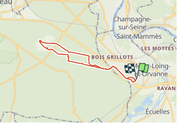
Trail Walking of 13.5 km to be discovered at Ile-de-France, Seine-et-Marne, Moret-Loing-et-Orvanne. This trail is proposed by randodan.
Description
Mercredi matin
Aller par Médicis et Rer Brûlé,
retour par Chêne Feuillu
(ce bout de Lefoin semble être une 1ère).
7 participants.
Positioning
Country:
France
Region :
Ile-de-France
Department/Province :
Seine-et-Marne
Municipality :
Moret-Loing-et-Orvanne
Location:
Moret-sur-Loing
Start:(Dec)
Start:(UTM)
485630 ; 5357304 (31U) N.
Comments