Trail Walking Moret-Loing-et-Orvanne - 120627-GLM - Moret-Malmontagne - Photo
 randodan
randodan

User

© OpenStreetMap contributors
Length
Length
12.9 km
Max alt
Max alt
138 m
Uphill gradient
Uphill gradient
138 m
Km-Effort
Km-Effort  
14.7 km
Min alt
Min alt
75 m
Downhill gradient
Downhill gradient
143 m
Boucle
Boucle
Yes
Creation date :
2014-12-10 00:00:00.0
Updated on :
2014-12-10 00:00:00.0

(0 Reviews)

Walking
Walking
3h28
Difficulty : Very easy

Scan this QR Code to open this trail in the SityTrail application

FREE GPS app for hiking

Logo SityTrail SityTrail

IGN / Geographical institutes

Download SityTrail from the App Store Download SityTrail from Google Play

Logo SityTrail SityTrail Plus

The world is yours!

Download SityTrail from the App Store Download SityTrail from Google Play Download SityTrail on Huawei AppGallery

About

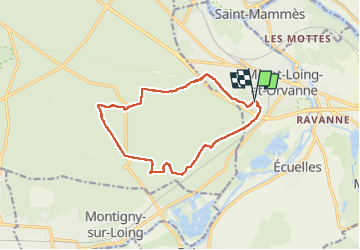
Trail Walking of 12.9 km to be discovered at Ile-de-France, Seine-et-Marne, Moret-Loing-et-Orvanne. This trail is proposed by randodan.

Description

Mercredi matin
Cap sur Malmontagne via GR11.
Pause croismt BoisPrieur-Râle.
Retour zig-zags sur Marion.
Mais Mi Ge qui devaient aller tout droit se perdent et arrivent 1h15 après nous.
7 2 participants

Elevation profile

Positioning

Country:
France
Region :
Ile-de-France
Department/Province :
Seine-et-Marne
Municipality :
Moret-Loing-et-Orvanne
Location:
Moret-sur-Loing
Start:(UTM)
485608 ; 5357252 (31U) N.


Close
My subscriptions