


port-vendres

phi14
User
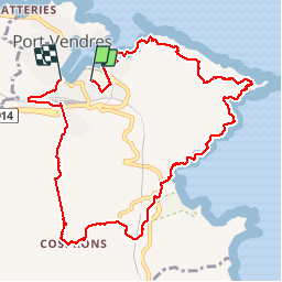

Length
12 km

Max alt
138 m

Uphill gradient
352 m
Km-Effort
16.7 km

Min alt
0 m

Downhill gradient
349 m
Boucle
No
Creation date :
2017-06-10 00:00:00.0
Updated on :
2017-06-10 00:00:00.0
4h21
Difficulty : Medium

FREE GPS app for hiking
 SityTrail
IGN / Geographical institutes
SityTrail Plus
The world is yours!
About
Trail Walking of 12 km to be discovered at Occitania, Pyrénées-Orientales, Port-Vendres. This trail is proposed by phi14.
Description
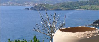
Belle promenade entre mer et vignoble.
Photos


Positioning
Country:
France
Region :
Occitania
Department/Province :
Pyrénées-Orientales
Municipality :
Port-Vendres
Location:
Unknown
Start:(Dec)
Start:(UTM)
509060 ; 4707054 (31T) N.
Comments