


Gerbier de jonc

philoustetou
User
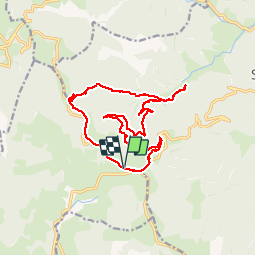

Length
16.7 km

Max alt
1421 m

Uphill gradient
580 m
Km-Effort
24 km

Min alt
933 m

Downhill gradient
579 m
Boucle
Yes
Creation date :
2014-12-10 00:00:00.0
Updated on :
2014-12-10 00:00:00.0
3h59
Difficulty : Medium

FREE GPS app for hiking
 SityTrail
IGN / Geographical institutes
SityTrail Plus
The world is yours!
About
Trail Walking of 16.7 km to be discovered at Auvergne-Rhône-Alpes, Ardèche, Sainte-Eulalie. This trail is proposed by philoustetou.
Description
Circuit autour du mont Gerbier de Jonc, facile mais attention à deux points assez mal indiqués si la végétation est dense: en quittant la RD 378 et au hameau du Pradal.
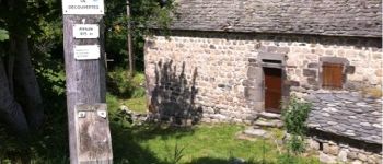
Photos


Positioning
Country:
France
Region :
Auvergne-Rhône-Alpes
Department/Province :
Ardèche
Municipality :
Sainte-Eulalie
Location:
Unknown
Start:(Dec)
Start:(UTM)
596268 ; 4966109 (31T) N.
Comments