


descente depuis Le Praz

p4philippe
User
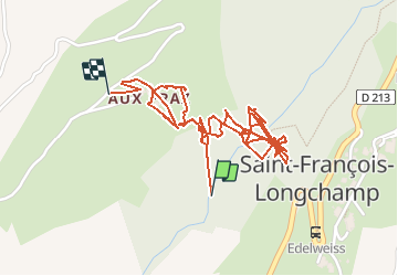

Length
3.4 km

Max alt
1427 m

Uphill gradient
296 m
Km-Effort
6.8 km

Min alt
1266 m

Downhill gradient
150 m
Boucle
No
Creation date :
2014-12-10 00:00:00.0
Updated on :
2014-12-10 00:00:00.0
49m
Difficulty : Medium

FREE GPS app for hiking
 SityTrail
IGN / Geographical institutes
SityTrail Plus
The world is yours!
About
Trail Walking of 3.4 km to be discovered at Auvergne-Rhône-Alpes, Savoy, Saint-François-Longchamp. This trail is proposed by p4philippe.
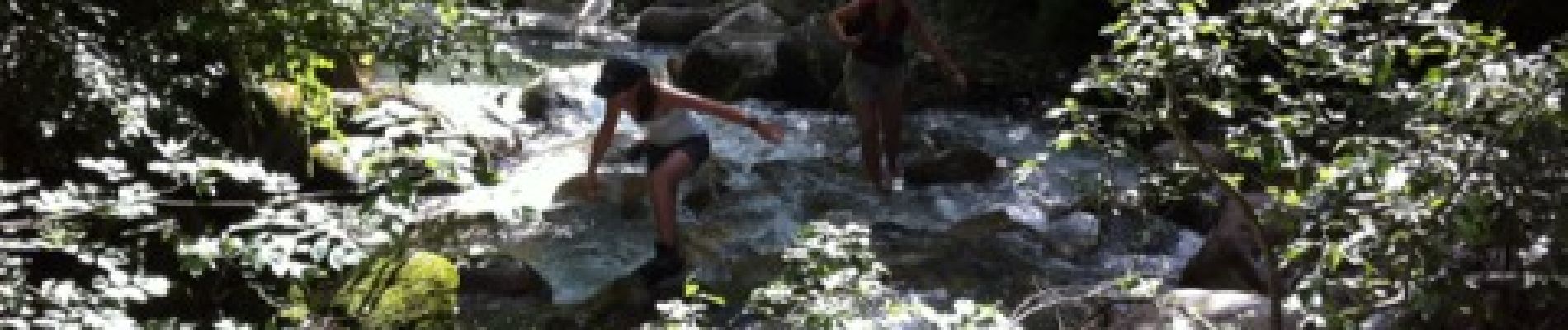
Photos


Positioning
Country:
France
Region :
Auvergne-Rhône-Alpes
Department/Province :
Savoy
Municipality :
Saint-François-Longchamp
Location:
Saint-François-Longchamp
Start:(Dec)
Start:(UTM)
291959 ; 5031730 (32T) N.
Comments