


plainfaing => lac blanc pour descente VTT

Chiroptere
User
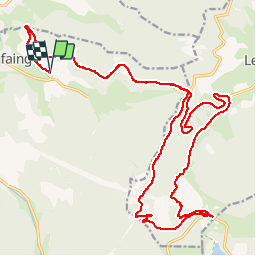

Length
30 km

Max alt
1157 m

Uphill gradient
836 m
Km-Effort
41 km

Min alt
593 m

Downhill gradient
834 m
Boucle
Yes
Creation date :
2014-12-10 00:00:00.0
Updated on :
2014-12-10 00:00:00.0
2h30
Difficulty : Easy

FREE GPS app for hiking
 SityTrail
IGN / Geographical institutes
SityTrail Plus
The world is yours!
About
Trail Mountain bike of 30 km to be discovered at Grand Est, Vosges, Plainfaing. This trail is proposed by Chiroptere.
Positioning
Country:
France
Region :
Grand Est
Department/Province :
Vosges
Municipality :
Plainfaing
Location:
Unknown
Start:(Dec)
Start:(UTM)
353660 ; 5337006 (32U) N.
Comments