Trail Walking Moret-Loing-et-Orvanne - 120808-GLM - Moret-RocherPrinces - Photo

120808-GLM - Moret-RocherPrinces

 randodan
randodan

User

© OpenStreetMap contributors
Length
Length
11.4 km
Max alt
Max alt
137 m
Uphill gradient
Uphill gradient
119 m
Km-Effort
Km-Effort  
12.9 km
Min alt
Min alt
83 m
Downhill gradient
Downhill gradient
119 m
Boucle
Boucle
Yes
Creation date :
2014-12-10 00:00:00.0
Updated on :
2014-12-10 00:00:00.0

(0 Reviews)

Walking
Walking
3h07
Difficulty : Very easy

Scan this QR Code to open this trail in the SityTrail application

FREE GPS app for hiking

Logo SityTrail SityTrail

IGN / Geographical institutes

Download SityTrail from the App Store Download SityTrail from Google Play

Logo SityTrail SityTrail Plus

The world is yours!

Download SityTrail from the App Store Download SityTrail from Google Play Download SityTrail on Huawei AppGallery

About

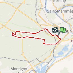
Trail Walking of 11.4 km to be discovered at Ile-de-France, Seine-et-Marne, Moret-Loing-et-Orvanne. This trail is proposed by randodan.

Description

Mercredi matin .
Aller classique par Veneux , Rte Rocher Besnard .
Pause au Rocher des Princes .
Retour par la Malmontagne (via le petit sentier SE/SW), Rosoir, Faluère . 8 participants.

Elevation profile

Photos

Points of interest

Point of interest Fontainebleau - Roche Percée - Photo
randodan
FONTAINEBLEAU 
Point of interest Fontainebleau - Rocher des Princes - Photo
randodan
FONTAINEBLEAU 

Positioning

Country:
France
Region :
Ile-de-France
Department/Province :
Seine-et-Marne
Municipality :
Moret-Loing-et-Orvanne
Location:
Moret-sur-Loing
Start:(UTM)
485617 ; 5357276 (31U) N.


Close
My subscriptions