


Tour de l'Ain 2012 - Etape 4

alexbnmr
User
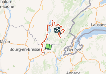

Length
162 km

Max alt
1152 m

Uphill gradient
3376 m
Km-Effort
205 km

Min alt
284 m

Downhill gradient
2914 m
Boucle
No
Creation date :
2014-12-10 00:00:00.0
Updated on :
2014-12-10 00:00:00.0
--
Difficulty : Difficult

FREE GPS app for hiking
 SityTrail
IGN / Geographical institutes
SityTrail Plus
The world is yours!
About
Trail Cycle of 162 km to be discovered at Auvergne-Rhône-Alpes, Ain, Nantua. This trail is proposed by alexbnmr.


Positioning
Country:
France
Region :
Auvergne-Rhône-Alpes
Department/Province :
Ain
Municipality :
Nantua
Location:
Unknown
Start:(Dec)
Start:(UTM)
700591 ; 5114484 (31T) N.
Comments