


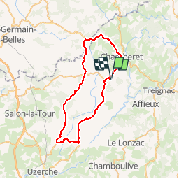
M7 Chamberet Surdoux Meilhards Condat Eyburie Rilhac-T

alexbnmr
User

Length
49 km

Max alt
612 m

Uphill gradient
784 m
Km-Effort
60 km

Min alt
335 m

Downhill gradient
784 m
Boucle
Yes
Creation date :
2014-12-10 00:00:00.0
Updated on :
2014-12-10 00:00:00.0
1h55
Difficulty : Medium

FREE GPS app for hiking
 SityTrail
IGN / Geographical institutes
SityTrail Plus
The world is yours!
About
Trail Cycle of 49 km to be discovered at New Aquitaine, Corrèze, Soudaine-Lavinadière. This trail is proposed by alexbnmr.


Positioning
Country:
France
Region :
New Aquitaine
Department/Province :
Corrèze
Municipality :
Soudaine-Lavinadière
Location:
Unknown
Start:(Dec)
Start:(UTM)
398610 ; 5044980 (31T) N.
Comments