


Trail du Galibier 2012

trailer38
User
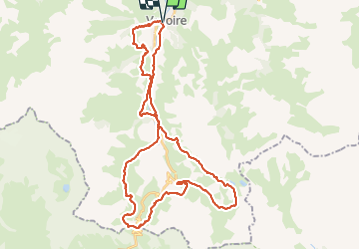

Length
45 km

Max alt
2679 m

Uphill gradient
2948 m
Km-Effort
84 km

Min alt
1415 m

Downhill gradient
2949 m
Boucle
Yes
Creation date :
2014-12-10 00:00:00.0
Updated on :
2014-12-10 00:00:00.0
--
Difficulty : Very difficult

FREE GPS app for hiking
 SityTrail
IGN / Geographical institutes
SityTrail Plus
The world is yours!
About
Trail Running of 45 km to be discovered at Auvergne-Rhône-Alpes, Savoy, Valloire. This trail is proposed by trailer38.
Description
trail difficile
Positioning
Country:
France
Region :
Auvergne-Rhône-Alpes
Department/Province :
Savoy
Municipality :
Valloire
Location:
Unknown
Start:(Dec)
Start:(UTM)
297792 ; 5004403 (32T) N.
Comments