LAC DU LAUZON

RD78-38
User

Length
8.8 km

Max alt
2026 m

Uphill gradient
802 m
Km-Effort
18.4 km

Min alt
1247 m

Downhill gradient
473 m
Boucle
No
Creation date :
2014-12-10 00:00:00.0
Updated on :
2020-07-11 00:26:09.165
3h39
Difficulty : Unknown

FREE GPS app for hiking
 SityTrail
IGN / Geographical institutes
SityTrail Plus
The world is yours!
About
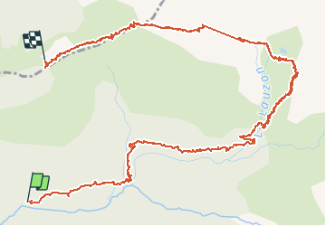
Trail Walking of 8.8 km to be discovered at Auvergne-Rhône-Alpes, Drôme, Lus-la-Croix-Haute. This trail is proposed by RD78-38.
Positioning
Country:
France
Region :
Auvergne-Rhône-Alpes
Department/Province :
Drôme
Municipality :
Lus-la-Croix-Haute
Location:
Unknown
Start:(Dec)
Start:(UTM)
720562 ; 4952476 (31T) N.
Comments