


Thillot vers Heudicourt

kikkko
User
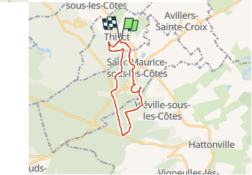

Length
10.2 km

Max alt
411 m

Uphill gradient
214 m
Km-Effort
13.1 km

Min alt
260 m

Downhill gradient
216 m
Boucle
Yes
Creation date :
2014-12-10 00:00:00.0
Updated on :
2014-12-10 00:00:00.0
--
Difficulty : Unknown

FREE GPS app for hiking
 SityTrail
IGN / Geographical institutes
SityTrail Plus
The world is yours!
About
Trail Walking of 10.2 km to be discovered at Grand Est, Meuse, Thillot. This trail is proposed by kikkko.
Positioning
Country:
France
Region :
Grand Est
Department/Province :
Meuse
Municipality :
Thillot
Location:
Unknown
Start:(Dec)
Start:(UTM)
695226 ; 5433738 (31U) N.
Comments
très belle rando ombragée