


Rando des renards 35k

guariso
User

Length
38 km

Max alt
180 m

Uphill gradient
580 m
Km-Effort
46 km

Min alt
92 m

Downhill gradient
580 m
Boucle
Yes
Creation date :
2014-12-10 00:00:00.0
Updated on :
2014-12-10 00:00:00.0
2h50
Difficulty : Medium

FREE GPS app for hiking
 SityTrail
IGN / Geographical institutes
SityTrail Plus
The world is yours!
About
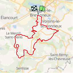
Trail Mountain bike of 38 km to be discovered at Ile-de-France, Yvelines, Montigny-le-Bretonneux. This trail is proposed by guariso.
Description
Pour la fête du VTT, le club de Montigny le bretoneux organisait le 9/9/12 4 parcours de VTT, dont un 35km assez technique malgré tout.
Positioning
Country:
France
Region :
Ile-de-France
Department/Province :
Yvelines
Municipality :
Montigny-le-Bretonneux
Location:
Unknown
Start:(Dec)
Start:(UTM)
428004 ; 5402576 (31U) N.
Comments
