Trail Walking Chichilianne - Vercors-120921(foEnC) - TourMtAiguille - Photo

Vercors-120921(foEnC) - TourMtAiguille

 randodan
randodan

User

© OpenStreetMap contributors
Length
Length
19 km
Max alt
Max alt
1710 m
Uphill gradient
Uphill gradient
1056 m
Km-Effort
Km-Effort  
33 km
Min alt
Min alt
976 m
Downhill gradient
Downhill gradient
1054 m
Boucle
Boucle
Yes
Creation date :
2014-12-10 00:00:00.0
Updated on :
2014-12-10 00:00:00.0

(0 Reviews)

Walking
Walking
7h01
Difficulty : Easy

Scan this QR Code to open this trail in the SityTrail application

FREE GPS app for hiking

Logo SityTrail SityTrail

IGN / Geographical institutes

Download SityTrail from the App Store Download SityTrail from Google Play

Logo SityTrail SityTrail World

The world is yours!

Download SityTrail from the App Store Download SityTrail from Google Play Download SityTrail on Huawei AppGallery

About

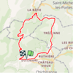
Trail Walking of 19 km to be discovered at Auvergne-Rhône-Alpes, Isère, Chichilianne. This trail is proposed by randodan.

Description

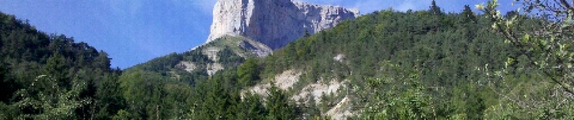
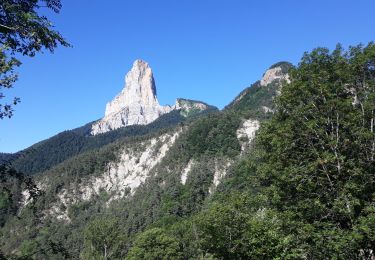
2012 - Vercors Manureva - 21 sep - Tour du Mont Aiguille .
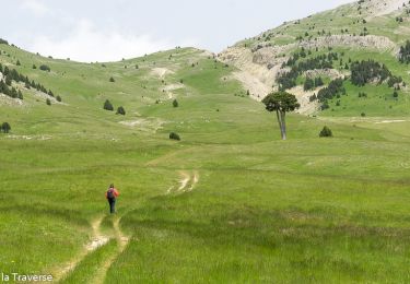
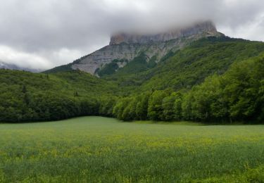
Départ Gai Soleil Richardière 8h30 (1040 m) . A Trezanne (1009 m), photo classique du Mont Aiguille derrière la chapelle . 10h40, 1245 m, Col de Papavet . Un peu de yoyo sur les crêtes, et 1/2h plus tard sommes au Col des Pellas, 1349 m . Redescendons sur le curieux village des Pellas (1104 m) avec ses toits en tôles peintes crème .
13h , 1450 m , pause casse-croûte vers la Cascade de la Pisse .
Après une dernière grimpette et la traversée des éboulis N.O. au pied du Mont Aiguille, 14h50, 1645 m, arrivons au "Collet" de l'Aupet (200 m à l'Est du vrai Col ; noter aussi que l'altitude de 1653 m portée sur le panneau est celle du sommet entre ces 2 cols !!) . Pour finir, une bonne descente (-600 m) jusqu'à la Richardière où nous arrivons juste, 16h20, pour une bonne "Préambulle" .
 
Nota : le balisage du Tour du Mt Aiguille n'est pratiquement pas identifiable .
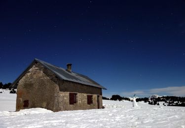
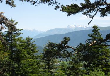
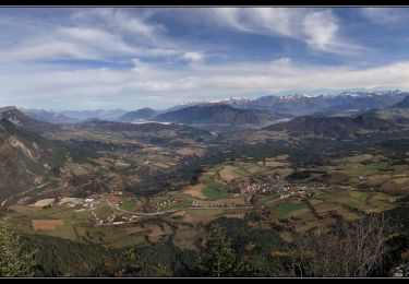
Elevation profile

Photos

Positioning

Country:
France
Region :
Auvergne-Rhône-Alpes
Department/Province :
Isère
Municipality :
Chichilianne
Location:
Unknown
Start:(UTM)
701576 ; 4966378 (31T) N.

Trails nearby

Trail Walking Chichilianne - Le Platary - Photo
Walking
patjobou

Walking

Medium
(2)
Chichilianne, Auvergne-Rhône-Alpes, Isère, France
6.6 km | 12.1 km-effort
2h 29min
Yes
Trail Walking Chichilianne - La Fontaine Pourrie - Hauts Plateaux Sud du Vercors - Photo
Walking
tracegps

Walking

Medium
(2)
Chichilianne, Auvergne-Rhône-Alpes, Isère, France
19.4 km | 33 km-effort
7h 45min
Yes
Trail Snowshoes Chichilianne - chichilianne archiane - Photo
Snowshoes
jerome-dupont@laposte.net

Snowshoes

Medium
(1)
Chichilianne, Auvergne-Rhône-Alpes, Isère, France
18.9 km | 32 km-effort
8h 0min
No
Trail Walking Gresse-en-Vercors -  Pas des Baschassons - Carrière romaine - Pas de la Selle - Photo
Walking
ilur56

Walking

Difficult
Gresse-en-Vercors, Auvergne-Rhône-Alpes, Isère, France
16.9 km | 31 km-effort
7h 0min
Yes
Trail Walking Saint-Martin-de-Clelles - Esclops Trièves tour du goutaroux - Photo
Walking
TOULAUDIN

Walking

Medium
Saint-Martin-de-Clelles, Auvergne-Rhône-Alpes, Isère, France
11 km | 18.8 km-effort
4h 58min
Yes
Trail Walking Chichilianne - Esclops Trièves Tour du Mont Aiguille - Photo
Walking
TOULAUDIN

Walking

Difficult
Chichilianne, Auvergne-Rhône-Alpes, Isère, France
16.6 km | 32 km-effort
7h 38min
Yes
Trail On foot Chichilianne - Pas de l'Aiguille - Photo
On foot
PRO

On foot

Medium
Chichilianne, Auvergne-Rhône-Alpes, Isère, France
17.1 km | 29 km-effort
6h 39min
Yes
Trail On foot Saint-Martin-de-Clelles - Chemin du Goutaroux - Photo
On foot
PRO

On foot

Easy
Saint-Martin-de-Clelles, Auvergne-Rhône-Alpes, Isère, France
4.2 km | 9.5 km-effort
2h 9min
No
Trail Walking Chichilianne - Sommets de Charbonnier & du Platary - Photo
Walking
flip38

Walking

Medium
Chichilianne, Auvergne-Rhône-Alpes, Isère, France
12.1 km | 21 km-effort
5h 24min
Yes


Close
My subscriptions