


121003-GLM - Moret-RocherPrinces

randodan
User
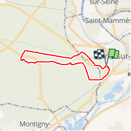

Length
12 km

Max alt
129 m

Uphill gradient
124 m
Km-Effort
13.7 km

Min alt
81 m

Downhill gradient
127 m
Boucle
Yes
Creation date :
2014-12-10 00:00:00.0
Updated on :
2014-12-10 00:00:00.0
3h34
Difficulty : Very easy

FREE GPS app for hiking
 SityTrail
IGN / Geographical institutes
SityTrail Plus
The world is yours!
About
Trail Walking of 12 km to be discovered at Ile-de-France, Seine-et-Marne, Moret-Loing-et-Orvanne. This trail is proposed by randodan.
Description
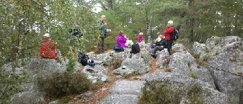
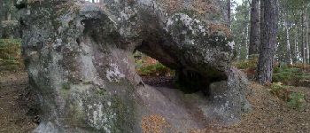
Mercredi matin . Wouah ! Ce matin, c'est Mireille qui conduit . Elle nous mène direct au Rocher des Princes . Au retour, petite pause aux pieds de Clotilde .
9 participants .
Photos


Positioning
Country:
France
Region :
Ile-de-France
Department/Province :
Seine-et-Marne
Municipality :
Moret-Loing-et-Orvanne
Location:
Moret-sur-Loing
Start:(Dec)
Start:(UTM)
485616 ; 5357288 (31U) N.
Comments