


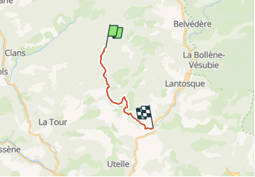
col d'andrion / le suquet

sylvainstaels
User

Length
12.1 km

Max alt
1691 m

Uphill gradient
132 m
Km-Effort
18.3 km

Min alt
338 m

Downhill gradient
1472 m
Boucle
No
Creation date :
2014-12-10 00:00:00.0
Updated on :
2014-12-10 00:00:00.0
1h03
Difficulty : Difficult

FREE GPS app for hiking
 SityTrail
IGN / Geographical institutes
SityTrail Plus
The world is yours!
About
Trail Mountain bike of 12.1 km to be discovered at Provence-Alpes-Côte d'Azur, Maritime Alps, Utelle. This trail is proposed by sylvainstaels.
Positioning
Country:
France
Region :
Provence-Alpes-Côte d'Azur
Department/Province :
Maritime Alps
Municipality :
Utelle
Location:
Unknown
Start:(Dec)
Start:(UTM)
358558 ; 4873218 (32T) N.
Comments