


mont vial premier

sylvainstaels
User
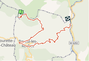

Length
9.8 km

Max alt
1515 m

Uphill gradient
140 m
Km-Effort
16.1 km

Min alt
189 m

Downhill gradient
1454 m
Boucle
No
Creation date :
2014-12-10 00:00:00.0
Updated on :
2014-12-10 00:00:00.0
--
Difficulty : Difficult

FREE GPS app for hiking
 SityTrail
IGN / Geographical institutes
SityTrail Plus
The world is yours!
About
Trail Mountain bike of 9.8 km to be discovered at Provence-Alpes-Côte d'Azur, Maritime Alps, Tourette-du-Château. This trail is proposed by sylvainstaels.
Positioning
Country:
France
Region :
Provence-Alpes-Côte d'Azur
Department/Province :
Maritime Alps
Municipality :
Tourette-du-Château
Location:
Unknown
Start:(Dec)
Start:(UTM)
351540 ; 4861918 (32T) N.
Comments