


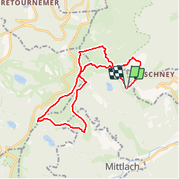
Schiessroth-Frankenthal-Falimont-Kastelberg-Hohneck-Schiessroth

delm
User

Length
15.2 km

Max alt
1355 m

Uphill gradient
759 m
Km-Effort
25 km

Min alt
1019 m

Downhill gradient
762 m
Boucle
Yes
Creation date :
2014-12-10 00:00:00.0
Updated on :
2014-12-10 00:00:00.0
5h07
Difficulty : Difficult

FREE GPS app for hiking
 SityTrail
IGN / Geographical institutes
SityTrail Plus
The world is yours!
About
Trail Walking of 15.2 km to be discovered at Grand Est, Haut-Rhin, Metzeral. This trail is proposed by delm.
Positioning
Country:
France
Region :
Grand Est
Department/Province :
Haut-Rhin
Municipality :
Metzeral
Location:
Unknown
Start:(Dec)
Start:(UTM)
353394 ; 5321437 (32U) N.
Comments