Trail Walking Moret-Loing-et-Orvanne - 
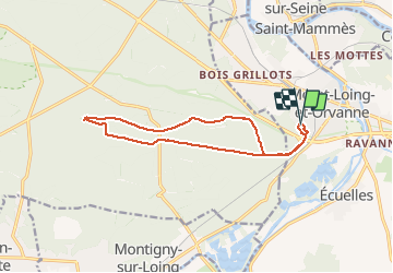
121024-GLM - Moret-Malmontagne - Photo
 randodan
randodan

User

© OpenStreetMap contributors
Length
Length
12.8 km
Max alt
Max alt
137 m
Uphill gradient
Uphill gradient
131 m
Km-Effort
Km-Effort  
14.6 km
Min alt
Min alt
83 m
Downhill gradient
Downhill gradient
134 m
Boucle
Boucle
Yes
Creation date :
2014-12-10 00:00:00.0
Updated on :
2014-12-10 00:00:00.0

(0 Reviews)

Walking
Walking
3h12
Difficulty : Very easy

Scan this QR Code to open this trail in the SityTrail application

FREE GPS app for hiking

Logo SityTrail SityTrail

IGN / Geographical institutes

Download SityTrail from the App Store Download SityTrail from Google Play

Logo SityTrail SityTrail Plus

The world is yours!

Download SityTrail from the App Store Download SityTrail from Google Play Download SityTrail on Huawei AppGallery

About

Trail Walking of 12.8 km to be discovered at Ile-de-France, Seine-et-Marne, Moret-Loing-et-Orvanne. This trail is proposed by randodan.

Description

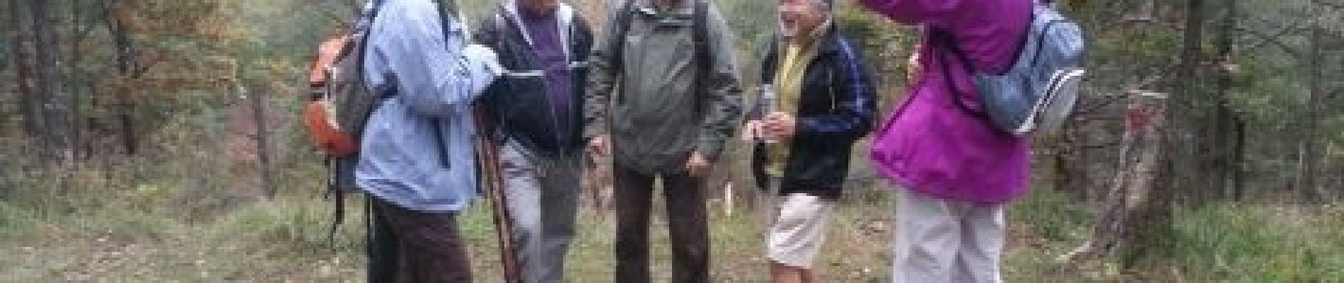
Mercredi matin . Zut, mon GPS est HS, c'est donc Bernard qui me fournira sa trace . Faluère, Biron, pause au PtVue Ouest de la Malmontagne . Au retour, micro crochet au PtVue de Claude . 8 participants .

Elevation profile

Photos

Points of interest

Point of interest Fontainebleau - Au point de vue ouest de la Malmontagne - Photo
randodan

Positioning

Country:
France
Region :
Ile-de-France
Department/Province :
Seine-et-Marne
Municipality :
Moret-Loing-et-Orvanne
Location:
Moret-sur-Loing
Start:(UTM)
485631 ; 5357278 (31U) N.


Close
My subscriptions