Trail Walking Sainte-Ouenne - St Ouenne - Photo
 olaze
olaze

User

© OpenStreetMap contributors
Length
Length
10.2 km
Max alt
Max alt
99 m
Uphill gradient
Uphill gradient
153 m
Km-Effort
Km-Effort  
12.3 km
Min alt
Min alt
39 m
Downhill gradient
Downhill gradient
153 m
Boucle
Boucle
Yes
Creation date :
2014-12-10 00:00:00.0
Updated on :
2014-12-10 00:00:00.0

(0 Reviews)

Walking
Walking
2h40
Difficulty : Medium

Scan this QR Code to open this trail in the SityTrail application

FREE GPS app for hiking

Logo SityTrail SityTrail

IGN / Geographical institutes

Download SityTrail from the App Store Download SityTrail from Google Play

Logo SityTrail SityTrail World

The world is yours!

Download SityTrail from the App Store Download SityTrail from Google Play Download SityTrail on Huawei AppGallery

About

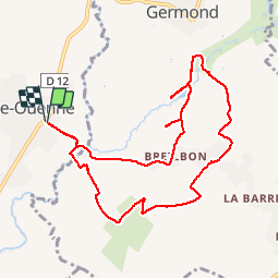
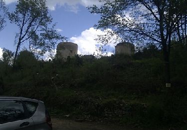
Trail Walking of 10.2 km to be discovered at New Aquitaine, Deux-Sèvres, Sainte-Ouenne. This trail is proposed by olaze.

Description

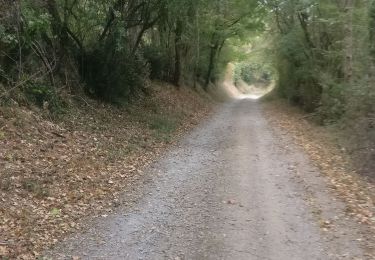
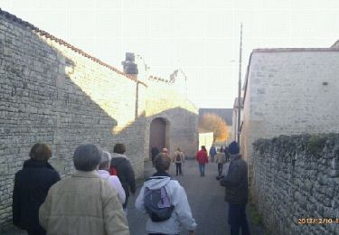
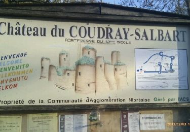
Promenade dans la campagne .
Breilbon,Germond Rouvre, les Moussandières.
Club rando Bessines .2012
         

Elevation profile

Photos

Points of interest

Point of interest Sainte-Ouenne - Point 2 - Photo
olaze
SAINTE-OUENNE 
Point of interest Germond-Rouvre - Restriction - Photo
olaze
GERMOND-ROUVRE 
Point of interest Germond-Rouvre - Restriction - Photo
olaze
GERMOND-ROUVRE 

Positioning

Country:
France
Region :
New Aquitaine
Department/Province :
Deux-Sèvres
Municipality :
Sainte-Ouenne
Location:
Unknown
Start:(UTM)
696425 ; 5146507 (30T) N.

Trails nearby

Trail Walking Germond-Rouvre - 2020-09-19  - Photo
Walking
cagouille79

Walking

Medium
Germond-Rouvre, New Aquitaine, Deux-Sèvres, France
12.9 km | 16.2 km-effort
2h 59min
Yes
Trail Walking Saint-Maxire - St Maxire  - Photo
Walking
olaze

Walking

Easy
Saint-Maxire, New Aquitaine, Deux-Sèvres, France
8 km | 9.4 km-effort
2h 6min
Yes
Trail Walking Échiré - Coudray-Salbart (6km) - Photo
Walking
olaze

Walking

Medium
Échiré, New Aquitaine, Deux-Sèvres, France
5.8 km | 7.2 km-effort
2h 4min
Yes
Trail Walking Échiré - Coudray Salbart 2 - Photo
Walking
olaze

Walking

Medium
Échiré, New Aquitaine, Deux-Sèvres, France
6 km | 7.2 km-effort
1h 33min
Yes
Trail Walking Échiré - Ternanteuil - Photo
Walking
olaze

Walking

Medium
Échiré, New Aquitaine, Deux-Sèvres, France
6.7 km | 8.2 km-effort
2h 23min
Yes
Trail Cycle Saint-Maxire - Niort Damvix V2 - Photo
Cycle
Ceclm

Cycle

Medium
Saint-Maxire, New Aquitaine, Deux-Sèvres, France
44 km | 48 km-effort
2h 47min
No
Trail Walking Sainte-Ouenne - Saint Ouenne (@) - Photo
Walking
olaze

Walking

Easy
Sainte-Ouenne, New Aquitaine, Deux-Sèvres, France
8.6 km | 10.5 km-effort
2h 30min
Yes
Trail Mountain bike Surin - 2012-09-23 Vallée de l'Egray (raccourcie) - Photo
Mountain bike
cagouille79

Mountain bike

Medium
Surin, New Aquitaine, Deux-Sèvres, France
16.6 km | 20 km-effort
1h 28min
Yes
Trail Bicycle tourism Champdeniers - Vélofrancette - Tronçon 5 - Photo
Bicycle tourism
ves

Bicycle tourism

Very easy
Champdeniers, New Aquitaine, Deux-Sèvres, France
111 km | 120 km-effort
Unknown
No


Close
My subscriptions