


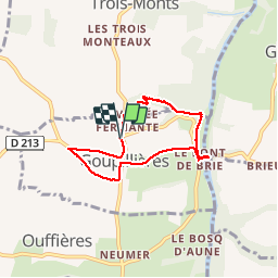
Autour de Gouvillières

Jeff_314
User

Length
5.5 km

Max alt
153 m

Uphill gradient
139 m
Km-Effort
7.3 km

Min alt
18 m

Downhill gradient
138 m
Boucle
Yes
Creation date :
2014-12-10 00:00:00.0
Updated on :
2014-12-10 00:00:00.0
1h59
Difficulty : Medium

FREE GPS app for hiking
 SityTrail
IGN / Geographical institutes
SityTrail Plus
The world is yours!
About
Trail Walking of 5.5 km to be discovered at Normandy, Calvados, Montillières-sur-Orne. This trail is proposed by Jeff_314.
Positioning
Country:
France
Region :
Normandy
Department/Province :
Calvados
Municipality :
Montillières-sur-Orne
Location:
Goupillières
Start:(Dec)
Start:(UTM)
684197 ; 5434422 (30U) N.
Comments