


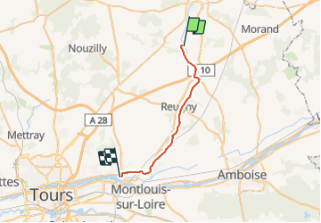
013 Villedomer Vouvray

lucille
User

Length
23 km

Max alt
121 m

Uphill gradient
250 m
Km-Effort
26 km

Min alt
50 m

Downhill gradient
272 m
Boucle
No
Creation date :
2014-12-10 00:00:00.0
Updated on :
2014-12-10 00:00:00.0
5h39
Difficulty : Unknown

FREE GPS app for hiking
 SityTrail
IGN / Geographical institutes
SityTrail Plus
The world is yours!
About
Trail Walking of 23 km to be discovered at Centre-Loire Valley, Indre-et-Loire, Villedômer. This trail is proposed by lucille.
Description
Villedômer / Vouvray
Camping Municipal Le bec Cisse
Positioning
Country:
France
Region :
Centre-Loire Valley
Department/Province :
Indre-et-Loire
Municipality :
Villedômer
Location:
Unknown
Start:(Dec)
Start:(UTM)
341565 ; 5267855 (31T) N.
Comments