Trail Walking Moret-Loing-et-Orvanne - 121219-GLM - Moret-RocherBrûlé - Photo

121219-GLM - Moret-RocherBrûlé

 randodan
randodan

User

© OpenStreetMap contributors
Length
Length
10.6 km
Max alt
Max alt
113 m
Uphill gradient
Uphill gradient
85 m
Km-Effort
Km-Effort  
11.8 km
Min alt
Min alt
83 m
Downhill gradient
Downhill gradient
87 m
Boucle
Boucle
Yes
Creation date :
2014-12-10 00:00:00.0
Updated on :
2014-12-10 00:00:00.0

(0 Reviews)

Walking
Walking
3h20
Difficulty : Very easy

Scan this QR Code to open this trail in the SityTrail application

FREE GPS app for hiking

Logo SityTrail SityTrail

IGN / Geographical institutes

Download SityTrail from the App Store Download SityTrail from Google Play

Logo SityTrail SityTrail Plus

The world is yours!

Download SityTrail from the App Store Download SityTrail from Google Play Download SityTrail on Huawei AppGallery

About

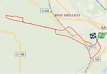
Trail Walking of 10.6 km to be discovered at Ile-de-France, Seine-et-Marne, Moret-Loing-et-Orvanne. This trail is proposed by randodan.

Description

Mercredi matin 19-12-12.<br>
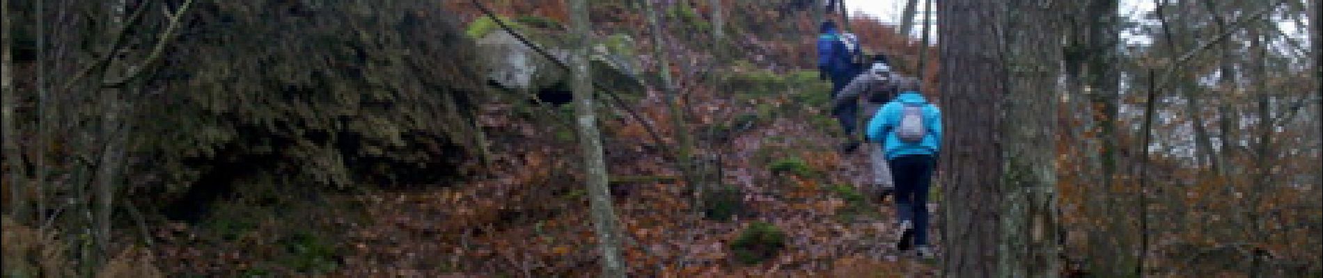
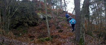
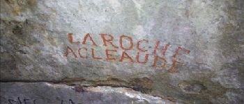
Au bout d’un moment de tout droit, je propose la Roche à Cleaude . La petite grimpette de l’Hallali sur la crête du Rocher Brûlé, certain(e)s auraient aimer avoir des crampons.<br>
Pause chamallows à la Roche à Cleaude.<br>
Retour par le bout de l’aqueduc et la Route des Buttes qui rappelle une aventure à Geneviève (voir la rando "120627-GLM - Moret-Malmontagne").<br>
4 participants.          

Elevation profile

Photos

Points of interest

Point of interest Fontainebleau - Route de l'Hallali, Rocher Brûlé - Photo
randodan
Point of interest Fontainebleau - Rocher Brûlé - Photo
randodan
FONTAINEBLEAU 

Positioning

Country:
France
Region :
Ile-de-France
Department/Province :
Seine-et-Marne
Municipality :
Moret-Loing-et-Orvanne
Location:
Moret-sur-Loing
Start:(UTM)
485629 ; 5357281 (31U) N.


Close
My subscriptions