


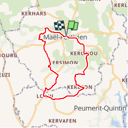
Maël-Pestivien - Chaire des druides

FabienneD
User

Length
13 km

Max alt
296 m

Uphill gradient
206 m
Km-Effort
15.7 km

Min alt
232 m

Downhill gradient
209 m
Boucle
Yes
Creation date :
2014-12-10 00:00:00.0
Updated on :
2014-12-10 00:00:00.0
3h24
Difficulty : Medium

FREE GPS app for hiking
 SityTrail
IGN / Geographical institutes
SityTrail Plus
The world is yours!
About
Trail Walking of 13 km to be discovered at Brittany, Côtes-d'Armor, Maël-Pestivien. This trail is proposed by FabienneD.
Description
Circuit de la chaire des druides
Description sur
http://www.callac-argoat.fr/Randonnees,82
Balisage jaune

Positioning
Country:
France
Region :
Brittany
Department/Province :
Côtes-d'Armor
Municipality :
Maël-Pestivien
Location:
Unknown
Start:(Dec)
Start:(UTM)
478049 ; 5360156 (30U) N.
Comments