Trail Walking Locarn - Gorges du Corong - Photo
© OpenStreetMap contributors
Length
Length
5 km
Max alt
Max alt
270 m
Uphill gradient
Uphill gradient
107 m
Km-Effort
Km-Effort  
6.4 km
Min alt
Min alt
180 m
Downhill gradient
Downhill gradient
107 m
Boucle
Boucle
Yes
Creation date :
2014-12-10 00:00:00.0
Updated on :
2014-12-10 00:00:00.0

(0 Reviews)

Walking
Walking
1h24
Difficulty : Easy

Scan this QR Code to open this trail in the SityTrail application

FREE GPS app for hiking

Logo SityTrail SityTrail

IGN / Geographical institutes

Download SityTrail from the App Store Download SityTrail from Google Play

Logo SityTrail SityTrail Plus

The world is yours!

Download SityTrail from the App Store Download SityTrail from Google Play Download SityTrail on Huawei AppGallery

About

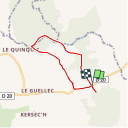
Trail Walking of 5 km to be discovered at Brittany, Côtes-d'Armor, Locarn. This trail is proposed by FabienneD.

Description

Locarn - Sentier à travers les landes jusqu'au Gorges du Corong
Balisage jaune

Elevation profile

Points of interest

Point of interest Saint-Servais - Gorges du Corong - Photo
FabienneD
SAINT-SERVAIS 
Point of interest Locarn - Menhir - Photo
FabienneD
LOCARN 
Point of interest Saint-Nicodème - Table Pique-Nique et Parking - Photo
FabienneD
Point of interest Locarn - Menhir - Photo
FabienneD
LOCARN 

Positioning

Country:
France
Region :
Brittany
Department/Province :
Côtes-d'Armor
Municipality :
Locarn
Location:
Unknown
Start:(UTM)
472782 ; 5353439 (30U) N.


Close
My subscriptions