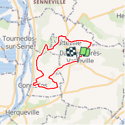
Daubeuf-près-Vateville - Connelles

marcel.F
User

Length
11.3 km

Max alt
142 m

Uphill gradient
226 m
Km-Effort
14.4 km

Min alt
11 m

Downhill gradient
227 m
Boucle
Yes
Creation date :
2017-09-10 00:00:00.0
Updated on :
2019-04-21 14:40:22.864
3h06
Difficulty : Easy

FREE GPS app for hiking
 SityTrail
IGN / Geographical institutes
SityTrail Plus
The world is yours!
About
Trail Walking of 11.3 km to be discovered at Normandy, Eure, Daubeuf-près-Vatteville. This trail is proposed by marcel.F.
Description
boucle au départ parking réserve incendie à Daubeuf-près-Vatteville
boucle via Connelles
Positioning
Country:
France
Region :
Normandy
Department/Province :
Eure
Municipality :
Daubeuf-près-Vatteville
Location:
Unknown
Start:(Dec)
Start:(UTM)
376458 ; 5458345 (31U) N.
Comments