


Cessenon Rives de l'Orb

jdelettrez
User
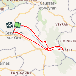

Length
12.5 km

Max alt
76 m

Uphill gradient
137 m
Km-Effort
14.4 km

Min alt
27 m

Downhill gradient
138 m
Boucle
Yes
Creation date :
2014-12-10 00:00:00.0
Updated on :
2014-12-10 00:00:00.0
3h11
Difficulty : Easy

FREE GPS app for hiking
 SityTrail
IGN / Geographical institutes
SityTrail Plus
The world is yours!
About
Trail Walking of 12.5 km to be discovered at Occitania, Hérault, Cessenon-sur-Orb. This trail is proposed by jdelettrez.
Description
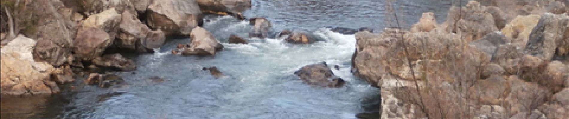
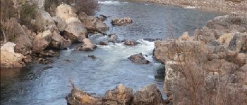
Les bords de l'orb entre Cessenon et Réals
Photos

Positioning
Country:
France
Region :
Occitania
Department/Province :
Hérault
Municipality :
Cessenon-sur-Orb
Location:
Unknown
Start:(Dec)
Start:(UTM)
503754 ; 4811044 (31T) N.
Comments
belle randonnée, paysage agréable
superbe application pour randonner facilement et agréablement