


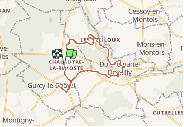
SLV-130112 - (AMAJ) Chalautre-Gurcy

randodan
User

Length
15.6 km

Max alt
145 m

Uphill gradient
250 m
Km-Effort
18.9 km

Min alt
74 m

Downhill gradient
252 m
Boucle
Yes
Creation date :
2014-12-10 00:00:00.0
Updated on :
2014-12-10 00:00:00.0
4h09
Difficulty : Unknown

FREE GPS app for hiking
 SityTrail
IGN / Geographical institutes
SityTrail Plus
The world is yours!
About
Trail Walking of 15.6 km to be discovered at Ile-de-France, Seine-et-Marne, Gurcy-le-Châtel. This trail is proposed by randodan.
Positioning
Country:
France
Region :
Ile-de-France
Department/Province :
Seine-et-Marne
Municipality :
Gurcy-le-Châtel
Location:
Unknown
Start:(Dec)
Start:(UTM)
506786 ; 5369744 (31U) N.
Comments
Gucy-Le-Châtel (77)