


rouya

bernardfor
User
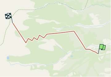

Length
2.6 km

Max alt
2602 m

Uphill gradient
781 m
Km-Effort
10.4 km

Min alt
1796 m

Downhill gradient
0 m
Boucle
No
Creation date :
2014-12-10 00:00:00.0
Updated on :
2014-12-10 00:00:00.0
1h00
Difficulty : Easy

FREE GPS app for hiking
 SityTrail
IGN / Geographical institutes
SityTrail Plus
The world is yours!
About
Trail Other activity of 2.6 km to be discovered at Provence-Alpes-Côte d'Azur, Hautes-Alpes, Vallouise-Pelvoux. This trail is proposed by bernardfor.
Description
retour avec tony 14/01/2013 sau dernier tronçon ski rando
Positioning
Country:
France
Region :
Provence-Alpes-Côte d'Azur
Department/Province :
Hautes-Alpes
Municipality :
Vallouise-Pelvoux
Location:
Vallouise
Start:(Dec)
Start:(UTM)
300133 ; 4970807 (32T) N.
Comments