


Laval de Nize

jdelettrez
User

Length
7.4 km

Max alt
615 m

Uphill gradient
285 m
Km-Effort
11.2 km

Min alt
381 m

Downhill gradient
285 m
Boucle
Yes
Creation date :
2014-12-10 00:00:00.0
Updated on :
2014-12-10 00:00:00.0
2h26
Difficulty : Easy

FREE GPS app for hiking
 SityTrail
IGN / Geographical institutes
SityTrail Plus
The world is yours!
About
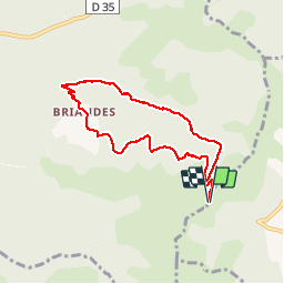
Trail Walking of 7.4 km to be discovered at Occitania, Hérault, Lavalette. This trail is proposed by jdelettrez.
Description
La rando du Valde Nize depuis St Amans
PR Balisage en Jaune
Passage aux Briandes, descentes vers Laval de Nyse puis remonter en suivant le lit de la rivière.
Ne pas empreinter par temps d'orage...
Positioning
Country:
France
Region :
Occitania
Department/Province :
Hérault
Municipality :
Lavalette
Location:
Unknown
Start:(Dec)
Start:(UTM)
520373 ; 4838036 (31T) N.
Comments
ideal en ete