


Octon ND de Roubignac

jdelettrez
User
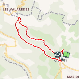

Length
7.8 km

Max alt
389 m

Uphill gradient
248 m
Km-Effort
11.1 km

Min alt
187 m

Downhill gradient
247 m
Boucle
Yes
Creation date :
2014-12-10 00:00:00.0
Updated on :
2014-12-10 00:00:00.0
2h23
Difficulty : Easy

FREE GPS app for hiking
 SityTrail
IGN / Geographical institutes
SityTrail Plus
The world is yours!
About
Trail Walking of 7.8 km to be discovered at Occitania, Hérault, Octon. This trail is proposed by jdelettrez.
Description
Une rando au départ d'Octon.
Utiliser le parking à coté de la cave Coopérative
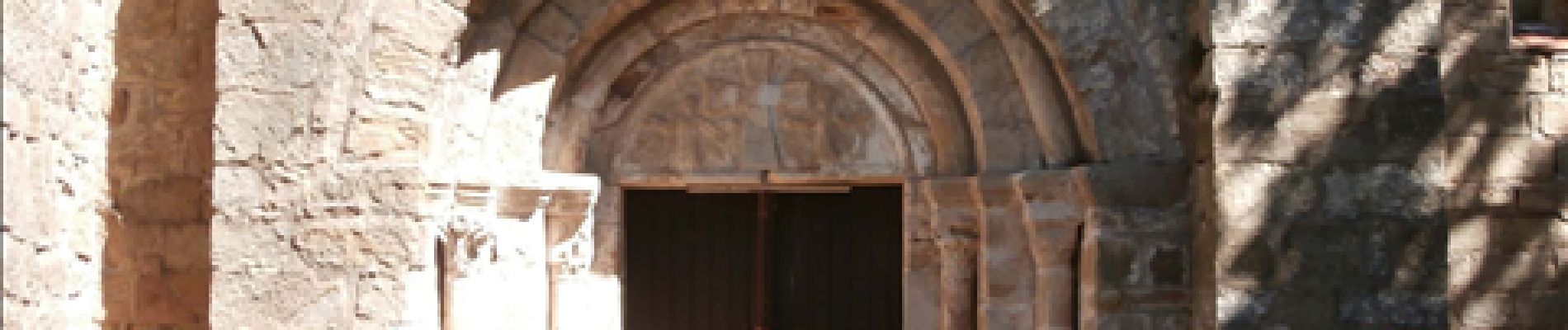
A voir : les ruines du chateau de Lauzières; La chapelle ND de roubignac
Photos


Positioning
Country:
France
Region :
Occitania
Department/Province :
Hérault
Municipality :
Octon
Location:
Unknown
Start:(Dec)
Start:(UTM)
524504 ; 4833488 (31T) N.
Comments