


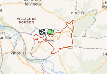
marche irancy du 27/01/2013

theo89
User

Length
14.4 km

Max alt
293 m

Uphill gradient
350 m
Km-Effort
19.1 km

Min alt
138 m

Downhill gradient
348 m
Boucle
Yes
Creation date :
2014-12-10 00:00:00.0
Updated on :
2014-12-10 00:00:00.0
2h30
Difficulty : Easy

FREE GPS app for hiking
 SityTrail
IGN / Geographical institutes
SityTrail Plus
The world is yours!
About
Trail Walking of 14.4 km to be discovered at Bourgogne-Franche-Comté, Yonne, Irancy. This trail is proposed by theo89.
Description
rando irancy
Positioning
Country:
France
Region :
Bourgogne-Franche-Comté
Department/Province :
Yonne
Municipality :
Irancy
Location:
Unknown
Start:(Dec)
Start:(UTM)
549744 ; 5284848 (31T) N.
Comments