Trail Walking Liettres - Deux jours de randonnée autour d'Aire sur la Lys - Etape 2 - Photo

Deux jours de randonnée autour d'Aire sur la Lys - Etape 2

 tracegps
tracegps

User

© OpenStreetMap contributors
Length
Length
23 km
Max alt
Max alt
81 m
Uphill gradient
Uphill gradient
222 m
Km-Effort
Km-Effort  
26 km
Min alt
Min alt
21 m
Downhill gradient
Downhill gradient
222 m
Boucle
Boucle
No
Creation date :
2014-12-10 00:00:00.0
Updated on :
2014-12-10 00:00:00.0

(0 Reviews)

Walking
Walking
6h00
Difficulty : Difficult

Scan this QR Code to open this trail in the SityTrail application

FREE GPS app for hiking

Logo SityTrail SityTrail

IGN / Geographical institutes

Download SityTrail from the App Store Download SityTrail from Google Play

Logo SityTrail SityTrail World

The world is yours!

Download SityTrail from the App Store Download SityTrail from Google Play Download SityTrail on Huawei AppGallery

About

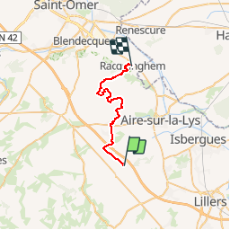
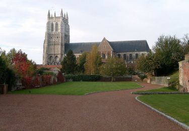
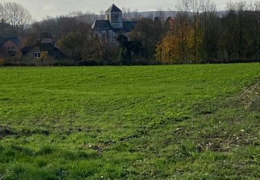
Trail Walking of 23 km to be discovered at Hauts-de-France, Pas-de-Calais, Liettres. This trail is proposed by tracegps.

Description

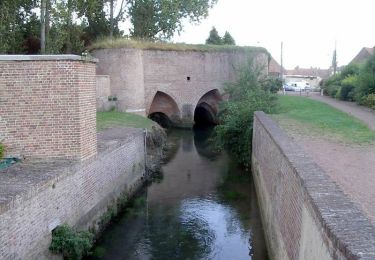
Départ de la chambre d'hôtes de Liettres. Après un bon petit-déjeuner, vous prendrez, au départ, la Via Francigena qui relie Canterbury à Rome. Actuellement, elle est détournée entre Liettres et Blessy par l'exploitation d'une carrière de craie, vous pouvez la contourner en restant sur le chemin et en la longeant par l'extérieur.

Elevation profile

Photos

Positioning

Country:
France
Region :
Hauts-de-France
Department/Province :
Pas-de-Calais
Municipality :
Liettres
Location:
Unknown
Start:(UTM)
453587 ; 5605097 (31U) N.

Trails nearby

Trail Walking Lambres - Le sentier de la Lacquette - Lambres les Aire - Photo
Walking
tracegps

Walking

Medium
(1)
Lambres, Hauts-de-France, Pas-de-Calais, France
11.1 km | 12.4 km-effort
2h 30min
Yes
Trail Walking Estrée-Blanche - Estrée Blanche - Photo
Walking
Greg813

Walking

Medium
Estrée-Blanche, Hauts-de-France, Pas-de-Calais, France
23 km | 26 km-effort
4h 29min
Yes
Trail Walking Ligny-lès-Aire - Mercredi 16/12/2020 - Photo
Walking
paixdroo

Walking

Very easy
Ligny-lès-Aire, Hauts-de-France, Pas-de-Calais, France
8.6 km | 9.6 km-effort
1h 57min
Yes
Trail Other activity Ligny-lès-Aire - Ligny to Ligny - Photo
Other activity
paixdroo

Other activity

Very easy
Ligny-lès-Aire, Hauts-de-France, Pas-de-Calais, France
15.2 km | 17.8 km-effort
3h 35min
Yes
Trail Walking Aire-sur-la-Lys - Sentier du Bruveau - Aire sur la Lys - Photo
Walking
tracegps

Walking

Medium
Aire-sur-la-Lys, Hauts-de-France, Pas-de-Calais, France
10.8 km | 11.7 km-effort
2h 40min
Yes
Trail Walking Aire-sur-la-Lys - Le marais - Aire-sur-la-Lys - Photo
Walking
tracegps

Walking

Medium
Aire-sur-la-Lys, Hauts-de-France, Pas-de-Calais, France
9.4 km | 9.9 km-effort
2h 19min
Yes
Trail Walking Ligny-lès-Aire - Dimanche 21/11/21 - Photo
Walking
paixdroo

Walking

Medium
(1)
Ligny-lès-Aire, Hauts-de-France, Pas-de-Calais, France
6.9 km | 7.7 km-effort
1h 32min
Yes
Trail Walking Ligny-lès-Aire - Ligny les Aire  - Photo
Walking
paixdroo

Walking

Medium
Ligny-lès-Aire, Hauts-de-France, Pas-de-Calais, France
7.9 km | 8.8 km-effort
1h 52min
Yes
Trail Walking Aire-sur-la-Lys - Promenade «à livres ouverts» à Aire sur la Lys - Photo
Walking
tracegps

Walking

Easy
Aire-sur-la-Lys, Hauts-de-France, Pas-de-Calais, France
2.8 km | 3 km-effort
1h 30min
Yes


Close
My subscriptions