Trail Walking Puylaurens - Boucle d'En Guibaud - Puylaurens - Photo

Boucle d'En Guibaud - Puylaurens

 tracegps
tracegps

User

© OpenStreetMap contributors
Length
Length
14.5 km
Max alt
Max alt
340 m
Uphill gradient
Uphill gradient
364 m
Km-Effort
Km-Effort  
19.3 km
Min alt
Min alt
181 m
Downhill gradient
Downhill gradient
359 m
Boucle
Boucle
Yes
Creation date :
2014-12-10 00:00:00.0
Updated on :
2014-12-10 00:00:00.0

(1 Reviews)

Walking
Walking
3h40
Difficulty : Difficult

Scan this QR Code to open this trail in the SityTrail application

FREE GPS app for hiking

Logo SityTrail SityTrail

IGN / Geographical institutes

Download SityTrail from the App Store Download SityTrail from Google Play

Logo SityTrail SityTrail World

The world is yours!

Download SityTrail from the App Store Download SityTrail from Google Play Download SityTrail on Huawei AppGallery

About

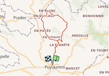
Trail Walking of 14.5 km to be discovered at Occitania, Tarn, Puylaurens. This trail is proposed by tracegps.

Description

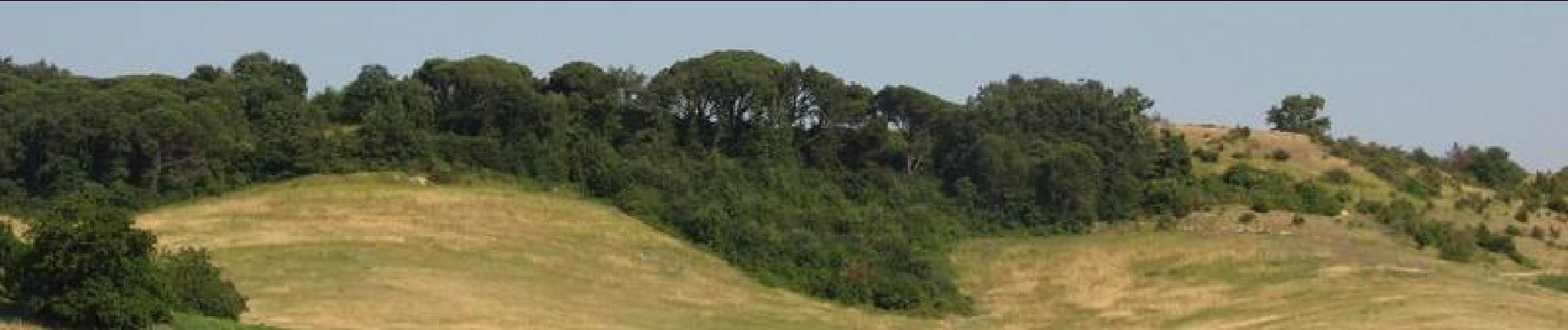
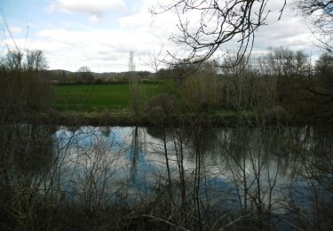
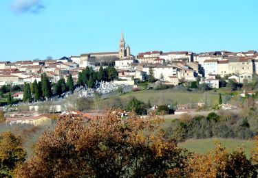
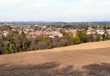
Départ de la route de Vielmur à Puylaurens pour une promenade sympa dans la superbe campagne tarnaise, Les riches terroirs agricoles nous offrent des paysages colorés au printemps et en été. En automne la terre brille après les labours et révèle boulbènes et terreforts ou des lentilles de calcaire. A la Métairie Haute, le pigeonnier, de type castrais, est coiffé d’un lanterneau dans la plus belle tradition locale. L’entrée du hameau d’en Guibaud est marquée par la présence d’un pigeonnier, ici de type toulousain, dont on aperçoit les trous de boulin. La montée vers un plateau caillouteux parsemé d’ajoncs conduit à la Ricaudié d’où l’on peut voir Puylaurens, la vallée de l’Agoût, la Montagne Noire avec le pic de Nore. Retrouvez les renseignements sur ce circuit sur le site du Comité Départemental du Tarn.

Elevation profile

Photos

Positioning

Country:
France
Region :
Occitania
Department/Province :
Tarn
Municipality :
Puylaurens
Location:
Unknown
Start:(UTM)
420077 ; 4825034 (31T) N.

Comments

Please log in to post a review or rate the element


rando plaisante pas trop difficile


Trails nearby

Trail Walking Puylaurens - Boucle de Saint Sébastien - Puylaurens - Photo
Walking
tracegps

Walking

Medium
Puylaurens, Occitania, Tarn, France
12 km | 16.3 km-effort
3h 30min
Yes
Trail Walking Puylaurens - Le grand 8 de Montaut - Photo
Walking
Emmanuelle Benoit

Walking

Medium
Puylaurens, Occitania, Tarn, France
8.3 km | 11.5 km-effort
2h 57min
Yes
Trail Walking Puylaurens - Puylaurens  - Photo
Walking
jpp2caunes

Walking

Difficult
Puylaurens, Occitania, Tarn, France
13.5 km | 18.1 km-effort
3h 50min
Yes
Trail Walking Puylaurens - puylaurens 2023 - Photo
Walking
Frayssinet

Walking

Very difficult
Puylaurens, Occitania, Tarn, France
22 km | 28 km-effort
6h 25min
Yes
Trail Walking Puylaurens - Puylaurens - Photo
Walking
philibar

Walking

Easy
Puylaurens, Occitania, Tarn, France
10.2 km | 13.7 km-effort
3h 5min
Yes
Trail Other activity Puylaurens - Saint-Sébastien - Photo
Other activity
jpp2caunes

Other activity

Very easy
Puylaurens, Occitania, Tarn, France
12.8 km | 17.2 km-effort
6h 27min
Yes
Trail Walking Puylaurens - Puylaurens St sebastien  - Photo
Walking
arqdan

Walking

Very easy
Puylaurens, Occitania, Tarn, France
12.8 km | 17.2 km-effort
3h 38min
Yes
Trail Mountain bike Puylaurens - voie romaine puylaurens - Photo
Mountain bike
cironav

Mountain bike

Easy
Puylaurens, Occitania, Tarn, France
26 km | 32 km-effort
3h 1min
Yes
Trail Walking Puylaurens - 81_Vielmur - Photo
Walking
jab31

Walking

Easy
Puylaurens, Occitania, Tarn, France
12.6 km | 17 km-effort
2h 28min
Yes


Close
My subscriptions