Trail Mountain bike Hangest-sur-Somme - Téléthon 2012 d'Hangest-Sur-Somme - Photo

Téléthon 2012 d'Hangest-Sur-Somme

 tracegps
tracegps

User

© OpenStreetMap contributors
Length
Length
28 km
Max alt
Max alt
116 m
Uphill gradient
Uphill gradient
359 m
Km-Effort
Km-Effort  
32 km
Min alt
Min alt
10 m
Downhill gradient
Downhill gradient
356 m
Boucle
Boucle
Yes
Creation date :
2014-12-10 00:00:00.0
Updated on :
2014-12-10 00:00:00.0

(0 Reviews)

Mountain bike
Mountain bike
2h30
Difficulty : Medium

Scan this QR Code to open this trail in the SityTrail application

FREE GPS app for hiking

Logo SityTrail SityTrail

IGN / Geographical institutes

Download SityTrail from the App Store Download SityTrail from Google Play

Logo SityTrail SityTrail World

The world is yours!

Download SityTrail from the App Store Download SityTrail from Google Play Download SityTrail on Huawei AppGallery

About

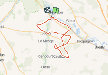
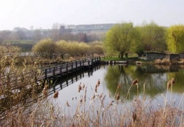
Trail Mountain bike of 28 km to be discovered at Hauts-de-France, Somme, Hangest-sur-Somme. This trail is proposed by tracegps.

Description

Circuit réalisé par le club VTT des Blaireaux de Picquigny pour la mairie d'Hangest-Sur-Somme à l'occasion du Téléthon 2012 (c'est donc un scoop puisqu’il n'a pas encore été dévoilé au grand public). Cette randonnée VTT est accessible à tous. Dénivelé et distance limités (30kms environ mais en forme de 8 permettant de couper si nécessaire et de réduire ainsi la distance à environ 20kms). Parcours bucolique constitué essentiellement de chemins vicinaux et parsemé de secteurs boisés magnifiques à cette saison sans oublier quelques portions roulantes intermédiaires.
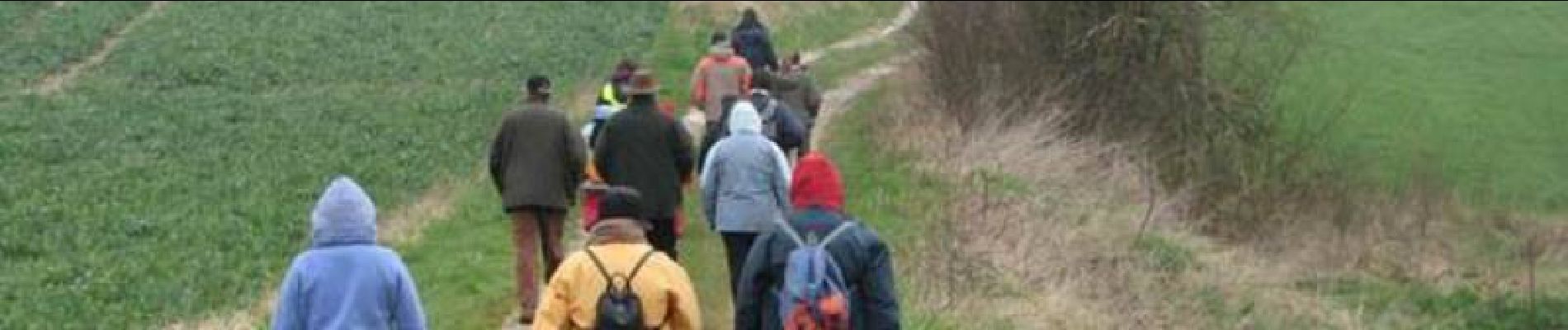
Elevation profile

Photos

Positioning

Country:
France
Region :
Hauts-de-France
Department/Province :
Somme
Municipality :
Hangest-sur-Somme
Location:
Unknown
Start:(UTM)
432966 ; 5536831 (31U) N.

Trails nearby

Trail Walking Ville-le-Marclet - ville le marclet - Photo
Walking
Cheyenne80

Walking

Very easy
Ville-le-Marclet, Hauts-de-France, Somme, France
10 km | 11.5 km-effort
2h 32min
Yes
Trail On foot Condé-Folie - Les Marais de Condé-Folie - Photo
On foot
PRO

On foot

Easy
Condé-Folie, Hauts-de-France, Somme, France
5.4 km | 5.7 km-effort
1h 18min
Yes
Trail Walking Hangest-sur-Somme - Circuit abbaye du Gard - Hangest sur Somme - Photo
Walking
tracegps

Walking

Very difficult
Hangest-sur-Somme, Hauts-de-France, Somme, France
16.6 km | 19.1 km-effort
4h 10min
Yes
Trail Walking Condé-Folie - Condé-Folie  - Photo
Walking
jpblimond

Walking

Medium
Condé-Folie, Hauts-de-France, Somme, France
17.2 km | 20 km-effort
3h 54min
Yes
Trail Walking Bourdon - Le Marais des Cavins - Bourdon  - Photo
Walking
tracegps

Walking

Easy
(1)
Bourdon, Hauts-de-France, Somme, France
3.1 km | 3.3 km-effort
1h 0min
Yes
Trail Electric bike Longpré-les-Corps-Saints - LONGPRE OISEMONT - Photo
Electric bike
ORTAX

Electric bike

Very easy
Longpré-les-Corps-Saints, Hauts-de-France, Somme, France
38 km | 42 km-effort
2h 30min
Yes
Trail Walking Hangest-sur-Somme - hangest - eaucourt - Photo
Walking
Jm Husson

Walking

Very difficult
Hangest-sur-Somme, Hauts-de-France, Somme, France
22 km | 25 km-effort
8h 30min
No
Trail Walking Bourdon - Dans les champs de Bourdon - Photo
Walking
camillederosiere

Walking

Very easy
Bourdon, Hauts-de-France, Somme, France
5.2 km | 6 km-effort
1h 15min
Yes
Trail Walking Hangest-sur-Somme - Hangest sur Somme - Photo
Walking
jpblimond

Walking

Medium
Hangest-sur-Somme, Hauts-de-France, Somme, France
16.8 km | 19.2 km-effort
4h 9min
Yes


Close
My subscriptions