Trail Walking Mouguerre - La croix de Mouguerre  - Photo
 tracegps
tracegps

User

© OpenStreetMap contributors
Length
Length
6.5 km
Max alt
Max alt
123 m
Uphill gradient
Uphill gradient
176 m
Km-Effort
Km-Effort  
8.8 km
Min alt
Min alt
1 m
Downhill gradient
Downhill gradient
176 m
Boucle
Boucle
Yes
Creation date :
2014-12-10 00:00:00.0
Updated on :
2014-12-10 00:00:00.0

(2 Reviews)

Walking
Walking
1h45
Difficulty : Easy

Scan this QR Code to open this trail in the SityTrail application

FREE GPS app for hiking

Logo SityTrail SityTrail

IGN / Geographical institutes

Download SityTrail from the App Store Download SityTrail from Google Play

Logo SityTrail SityTrail World

The world is yours!

Download SityTrail from the App Store Download SityTrail from Google Play Download SityTrail on Huawei AppGallery

About

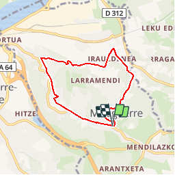
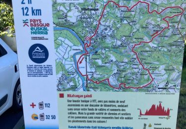
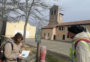
Trail Walking of 6.5 km to be discovered at New Aquitaine, Pyrénées-Atlantiques, Mouguerre. This trail is proposed by tracegps.

Description

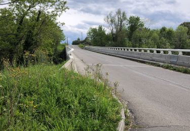
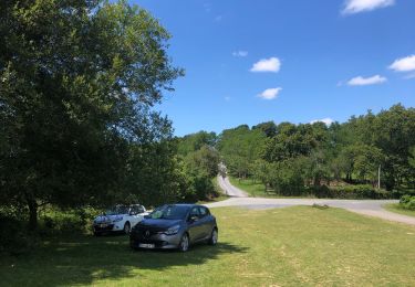
Rando facile (2h30 avec un enfant) qui démarre au parking de l'église de Mouguerre. Finir par la croix de Mouguerre (sens inverse des aiguilles d'une montre) pour avoir un objectif ,la croix et le mémorial, avec un beau point de vue. Quelques passages en sous bois pouvant être humides et quelques routes peu fréquentées.

Elevation profile

Photos

Positioning

Country:
France
Region :
New Aquitaine
Department/Province :
Pyrénées-Atlantiques
Municipality :
Mouguerre
Location:
Unknown
Start:(UTM)
628131 ; 4813905 (30T) N.

Comments

Please log in to post a review or rate the element


intéressant. je vais tester pour un an


Trails nearby

Trail Walking Villefranque - MILLAFRANGAN GAINDI - Villefranque  - Photo
Walking
DECHAMPD

Walking

Easy
Villefranque, New Aquitaine, Pyrénées-Atlantiques, France
12.9 km | 18.1 km-effort
3h 10min
Yes
Trail Walking Hasparren - Boucle Pilota Plaza Hasparren Briscous - Photo
Walking
jaja64

Walking

Very easy
Hasparren, New Aquitaine, Pyrénées-Atlantiques, France
11.2 km | 14.3 km-effort
2h 42min
Yes
Trail Walking Hasparren - Landes Hasparren  - Photo
Walking
jaja64

Walking

Easy
Hasparren, New Aquitaine, Pyrénées-Atlantiques, France
8.7 km | 11.5 km-effort
2h 41min
Yes
Trail Walking Bayonne - Plaine d'ANSOT Bayonne - Photo
Walking
jaja64

Walking

Easy
Bayonne, New Aquitaine, Pyrénées-Atlantiques, France
8.4 km | 9 km-effort
2h 13min
Yes
Trail Walking Saint-Pierre-d'Irube - balade decouverte Mouguerre - Photo
Walking
alex12r

Walking

Difficult
Saint-Pierre-d'Irube, New Aquitaine, Pyrénées-Atlantiques, France
5.7 km | 7.6 km-effort
1h 56min
Yes
Trail Walking Lahonce - LAHONCE sentier de labaye formation balisage miden
Walking
GUIDE
marmotte65

Walking

Easy
Lahonce, New Aquitaine, Pyrénées-Atlantiques, France
2.3 km | 3.1 km-effort
1h 30min
Yes
Trail Mountain bike Lahonce - Rando mitounico - Photo
Mountain bike
Anthony Sol

Mountain bike

Medium
Lahonce, New Aquitaine, Pyrénées-Atlantiques, France
23 km | 25 km-effort
3h 4min
Yes
Trail Walking Bayonne - Bayonne-,Anglet Chambre d'Amour - Photo
Walking
rigol05

Walking

Medium
Bayonne, New Aquitaine, Pyrénées-Atlantiques, France
12.3 km | 13.1 km-effort
2h 59min
No
Trail Walking Bayonne - jour 12, le 06/07/2023 - Photo
Walking
Céline Charbonnieras

Walking

Difficult
Bayonne, New Aquitaine, Pyrénées-Atlantiques, France
14.8 km | 16.8 km-effort
3h 26min
No


Close
My subscriptions