


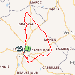
Circuit du tumulus

CANON2
User

Length
13.4 km

Max alt
348 m

Uphill gradient
232 m
Km-Effort
16.5 km

Min alt
211 m

Downhill gradient
234 m
Boucle
Yes
Creation date :
2019-05-15 13:10:20.778
Updated on :
2019-05-15 13:10:20.858
3h40
Difficulty : Easy

FREE GPS app for hiking
 SityTrail
IGN / Geographical institutes
SityTrail Plus
The world is yours!
About
Trail Walking of 13.4 km to be discovered at Occitania, Tarn, Lautrec. This trail is proposed by CANON2.
Description
sans aucuns intérêts!
Positioning
Country:
France
Region :
Occitania
Department/Province :
Tarn
Municipality :
Lautrec
Location:
Unknown
Start:(Dec)
Start:(UTM)
430509 ; 4839776 (31T) N.
Comments