


FONTAINE LE PORT - CHAMPAGNE SUR SEINE

NUITEVEN
User
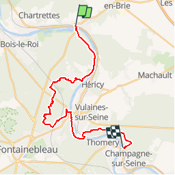

Length
24 km

Max alt
151 m

Uphill gradient
375 m
Km-Effort
29 km

Min alt
40 m

Downhill gradient
366 m
Boucle
No
Creation date :
2017-12-03 00:00:00.0
Updated on :
2017-12-03 00:00:00.0
6h23
Difficulty : Very easy

FREE GPS app for hiking
 SityTrail
IGN / Geographical institutes
SityTrail Plus
The world is yours!
About
Trail Walking of 24 km to be discovered at Ile-de-France, Seine-et-Marne, Fontaine-le-Port. This trail is proposed by NUITEVEN.
Positioning
Country:
France
Region :
Ile-de-France
Department/Province :
Seine-et-Marne
Municipality :
Fontaine-le-Port
Location:
Unknown
Start:(Dec)
Start:(UTM)
481609 ; 5370454 (31U) N.
Comments