


Col de Llauro- Roc del Quers

perittel
User
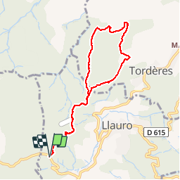

Length
8.9 km

Max alt
456 m

Uphill gradient
304 m
Km-Effort
12.9 km

Min alt
208 m

Downhill gradient
305 m
Boucle
Yes
Creation date :
2014-12-10 00:00:00.0
Updated on :
2014-12-10 00:00:00.0
3h11
Difficulty : Easy

FREE GPS app for hiking
 SityTrail
IGN / Geographical institutes
SityTrail Plus
The world is yours!
About
Trail Walking of 8.9 km to be discovered at Occitania, Pyrénées-Orientales, Llauro. This trail is proposed by perittel.
Description
Petite rando facile ;-))
Positioning
Country:
France
Region :
Occitania
Department/Province :
Pyrénées-Orientales
Municipality :
Llauro
Location:
Unknown
Start:(Dec)
Start:(UTM)
477593 ; 4710228 (31T) N.
Comments
