


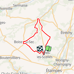
2013-02-18 Rando Brières les Scellés - Villeconin A/R

jchezlemas
User

Length
21 km

Max alt
157 m

Uphill gradient
253 m
Km-Effort
24 km

Min alt
87 m

Downhill gradient
254 m
Boucle
Yes
Creation date :
2014-12-10 00:00:00.0
Updated on :
2014-12-10 00:00:00.0
5h18
Difficulty : Easy

FREE GPS app for hiking
 SityTrail
IGN / Geographical institutes
SityTrail Plus
The world is yours!
About
Trail Walking of 21 km to be discovered at Ile-de-France, Essonne, Brières-les-Scellés. This trail is proposed by jchezlemas.
Positioning
Country:
France
Region :
Ile-de-France
Department/Province :
Essonne
Municipality :
Brières-les-Scellés
Location:
Unknown
Start:(Dec)
Start:(UTM)
436242 ; 5367490 (31U) N.
Comments