


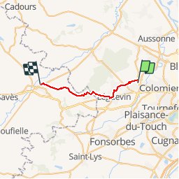
S-J-PIBRAC-L''ISLE JOURDAIN

CANON2
User

Length
21 km

Max alt
303 m

Uphill gradient
309 m
Km-Effort
25 km

Min alt
149 m

Downhill gradient
326 m
Boucle
No
Creation date :
2019-05-15 13:10:11.289
Updated on :
2019-05-15 13:10:11.36
5h00
Difficulty : Medium

FREE GPS app for hiking
 SityTrail
IGN / Geographical institutes
SityTrail Plus
The world is yours!
About
Trail Walking of 21 km to be discovered at Occitania, Haute-Garonne, Pibrac. This trail is proposed by CANON2.
Positioning
Country:
France
Region :
Occitania
Department/Province :
Haute-Garonne
Municipality :
Pibrac
Location:
Unknown
Start:(Dec)
Start:(UTM)
361314 ; 4831017 (31T) N.
Comments