


V2

vdub199
User
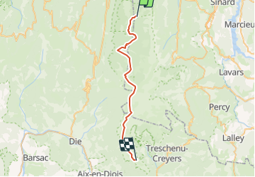

Length
30 km

Max alt
1982 m

Uphill gradient
1133 m
Km-Effort
45 km

Min alt
1389 m

Downhill gradient
936 m
Boucle
No
Creation date :
2014-12-10 00:00:00.0
Updated on :
2014-12-10 00:00:00.0
9h00
Difficulty : Difficult

FREE GPS app for hiking
 SityTrail
IGN / Geographical institutes
SityTrail Plus
The world is yours!
About
Trail Winter sports of 30 km to be discovered at Auvergne-Rhône-Alpes, Isère, Saint-Andéol. This trail is proposed by vdub199.
Description
Tiolache - chatillon


Positioning
Country:
France
Region :
Auvergne-Rhône-Alpes
Department/Province :
Isère
Municipality :
Saint-Andéol
Location:
Unknown
Start:(Dec)
Start:(UTM)
696513 ; 4977710 (31T) N.
Comments