


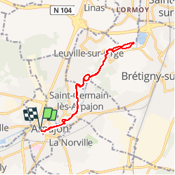
2013-03-13 Rando Arpajon les bords de l'orge

jchezlemas
User

Length
12.9 km

Max alt
54 m

Uphill gradient
87 m
Km-Effort
14.1 km

Min alt
39 m

Downhill gradient
87 m
Boucle
Yes
Creation date :
2014-12-10 00:00:00.0
Updated on :
2014-12-10 00:00:00.0
3h07
Difficulty : Very easy

FREE GPS app for hiking
 SityTrail
IGN / Geographical institutes
SityTrail Plus
The world is yours!
About
Trail Walking of 12.9 km to be discovered at Ile-de-France, Essonne, Arpajon. This trail is proposed by jchezlemas.
Positioning
Country:
France
Region :
Ile-de-France
Department/Province :
Essonne
Municipality :
Arpajon
Location:
Unknown
Start:(Dec)
Start:(UTM)
444192 ; 5382158 (31U) N.
Comments