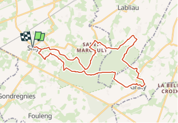
![](/images/other/stat-length.png)
![Trail Walking Silly - RB-Ha-03 - Du pays des carrières au parc naturel des Collines - Photo](https://media.geolcdn.com/t/1900/400/ext.pjpeg?maxdim=2&url=https%3A%2F%2Fservices.sitytrail.com%2FGeolivesWS%2FDownloadMedia.ashx%3FTrailID%3D179596%26Media%3Dd7099cfa-d7c9-4bf3-bdfa-78aa37eb10bb.jpg)
RB-Ha-03 - Du pays des carrières au parc naturel des Collines
GR Rando
Randonnez sur et autour des GR ® wallons (Sentiers de Grande Randonnée). PRO
![Length](/images/other/stat-length.png)
![Max alt](https://static1.geolcdn.com/siteimages/upload/files/1508320355ic_sort_altitude_max_24dp.png)
![Uphill gradient](https://static1.geolcdn.com/siteimages/upload/files/1508320355ic_sort_den_pos_24dp.png)
![Km-Effort](/images/other/stat-length.png)
![Min alt](https://static1.geolcdn.com/siteimages/upload/files/1508320355ic_sort_altitude_min_24dp.png)
![Downhill gradient](https://static1.geolcdn.com/siteimages/upload/files/1508320355ic_sort_den_neg_24dp.png)
![Boucle](https://static1.geolcdn.com/siteimages/upload/files/16400158638029165_repeat_loop_refresh_sync_direction_icon.png)
![Walking](https://static1.geolcdn.com/sitytour/trail-icons/101.png)
5h14
Difficulty : Very difficult
![Scan this QR Code to open this trail in the SityTrail application](https://capi.geolives.com/qq0zvz2zws4bq2lad0pu/sitytour/trails/179596/qr.png?size=200)
FREE GPS app for hiking
About
Trail Walking of 19 km to be discovered at Wallonia, Hainaut, Silly. This trail is proposed by GR Rando.
Description
Lessines – Ogy – Flobecq – Wodecq – Ogy – Lessines
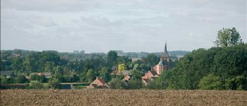
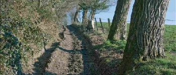
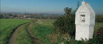
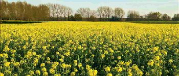
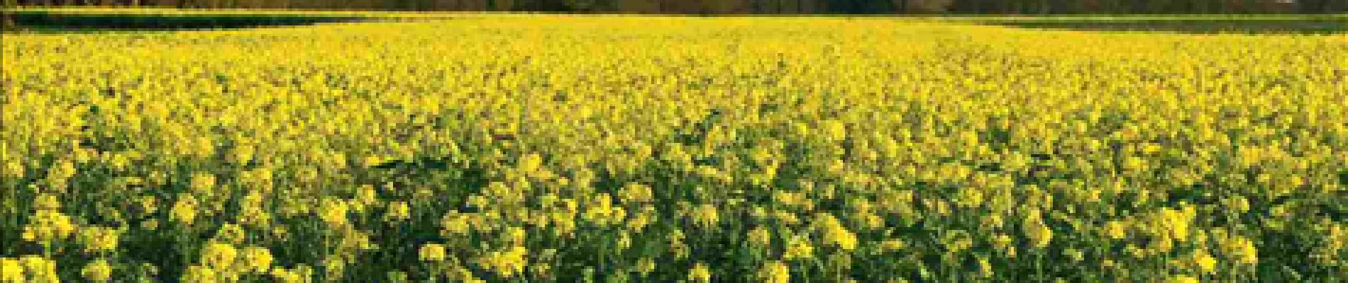
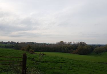
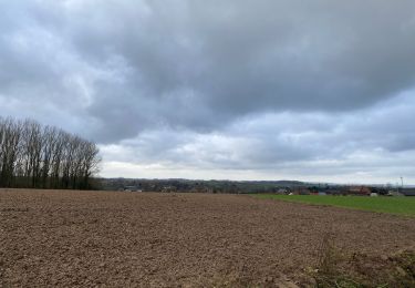
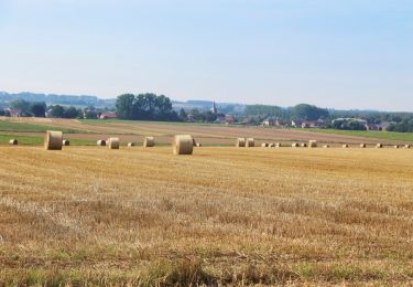
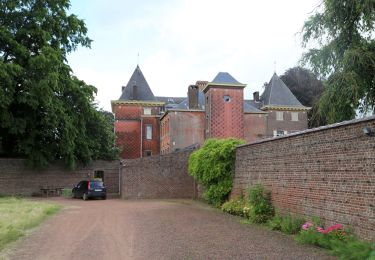
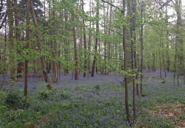
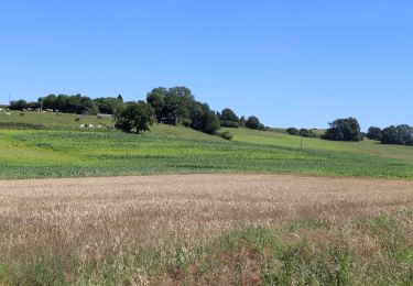
Lessines est bâtie sur les rives de la Dendre. Tout alentour, les chemins agricoles parcourent les molles ondulations de la campagne. Le relief s’accentue aux portes de Flobecq, située au coeur du parc naturel du Pays des Collines. Les promeneurs seront sensibles au charme paysager de cette région, où les ruisseaux ont creusé le relief de profonds vallons. Saules têtards et peupliers quadrillent la campagne et forment un bocage pittoresque.
Cartographie et documentation:
Cartes IGN au 1 : 20 000, 30/5-6 « Flobecq (Vloesberg) – Brakel » et 38/1-2
« Mainvault – Lessines ».
Topo-guide des GR 123/121 « Tour du Hainaut occidental ».
Où se désaltérer et se restaurer :
Le randonneur trouvera, bien sûr, cafés et restaurants à Lessines et à Flobecq. De
même, à Wodecq, un bistrot accueillant se situe à proximité de l’église.
Le Pays des Collines ne manque pas de chambres d’hôtes.
Positioning
Comments
Trails nearby
![Trail Walking Silly - HT-06_complet - Photo](https://media.geolcdn.com/t/375/260/ext.jpg?maxdim=2&url=https%3A%2F%2Fmedia.geolcdn.com%2Ff%2Ff966d4d2-0dc0-4cd6-bca7-03c18785f611.jpg)
![Walking Walking](https://static1.geolcdn.com/sitytour/trail-icons/101.png)
Walking
![](/images/other/stat-length.png)
![](https://static1.geolcdn.com/siteimages/upload/files/16400158638029165_repeat_loop_refresh_sync_direction_icon.png)
![Trail Walking Silly - Wapi 3.02 - La promenade des Princes - Silly - Photo](https://media.geolcdn.com/t/375/260/ext.jpg?maxdim=2&url=https%3A%2F%2Fmedia.geolcdn.com%2Ff%2F98872b19-6c1a-4965-9bd7-5d3e9b88372a.jpg)
![Walking Walking](https://static1.geolcdn.com/sitytour/trail-icons/101.png)
Walking
![](/images/other/stat-length.png)
![](https://static1.geolcdn.com/siteimages/upload/files/16400158638029165_repeat_loop_refresh_sync_direction_icon.png)
![Trail Walking Ath - Dimanche 20/12/2020 - Photo](https://media.geolcdn.com/t/375/260/ext.jpg?maxdim=2&url=https%3A%2F%2Fmedia.geolcdn.com%2Ff%2Fe7853499-b082-4f1a-bcac-5b446950aa41.jpg)
![Walking Walking](https://static1.geolcdn.com/sitytour/trail-icons/101.png)
Walking
![](/images/other/stat-length.png)
![](https://static1.geolcdn.com/siteimages/upload/files/16400158638029165_repeat_loop_refresh_sync_direction_icon.png)
![Trail On foot Silly - Hamlets and highlights of Bassily-Hellebecq - Photo](https://media.geolcdn.com/t/375/260/ext.jpg?maxdim=2&url=https%3A%2F%2Fpivotmedia.tourismewallonie.be%2FANX-02-04K1-001F%2FANX-02-04K1-001F.JPG)
![On foot On foot](https://static1.geolcdn.com/sitytour/trail-icons/100.png)
On foot
![](/images/other/stat-length.png)
![](https://static1.geolcdn.com/siteimages/upload/files/16400158638029165_repeat_loop_refresh_sync_direction_icon.png)
![Trail On foot Silly - Walk around castles and Bois de la Provision wood - Photo](https://media.geolcdn.com/t/375/260/ext.jpg?maxdim=2&url=https%3A%2F%2Fpivotmedia.tourismewallonie.be%2FANX-02-04OE-001F%2FANX-02-04OE-001F.JPG)
![On foot On foot](https://static1.geolcdn.com/sitytour/trail-icons/100.png)
On foot
![](/images/other/stat-length.png)
![](https://static1.geolcdn.com/siteimages/upload/files/16400158638029165_repeat_loop_refresh_sync_direction_icon.png)
![Trail On foot Silly - The Saint Marcoult Scrubland Walking Tour - Photo](https://media.geolcdn.com/t/375/260/ext.jpg?maxdim=2&url=https%3A%2F%2Fpivotmedia.tourismewallonie.be%2FANX-02-04OQ-005G%2FANX-02-04OQ-005G.JPG)
![On foot On foot](https://static1.geolcdn.com/sitytour/trail-icons/100.png)
On foot
![](/images/other/stat-length.png)
![](https://static1.geolcdn.com/siteimages/upload/files/16400158638029165_repeat_loop_refresh_sync_direction_icon.png)
![Trail On foot Silly - Princes’ walk - Photo](https://media.geolcdn.com/t/375/260/ext.jpg?maxdim=2&url=https%3A%2F%2Fpivotmedia.tourismewallonie.be%2FANX-02-04OT-001F%2FANX-02-04OT-001F.JPG)
![On foot On foot](https://static1.geolcdn.com/sitytour/trail-icons/100.png)
![Trail On foot Silly - Thoricourt, its pathways and wooded hills - Photo](https://media.geolcdn.com/t/375/260/ext.jpg?maxdim=2&url=https%3A%2F%2Fpivotmedia.tourismewallonie.be%2FANX-02-03WK-008K%2FANX-02-03WK-008K.JPG)
![On foot On foot](https://static1.geolcdn.com/sitytour/trail-icons/100.png)
On foot
![](/images/other/stat-length.png)
![](https://static1.geolcdn.com/siteimages/upload/files/16400158638029165_repeat_loop_refresh_sync_direction_icon.png)
![Trail Walking Silly - w-belgie-gondregnies - Photo](https://media.geolcdn.com/t/375/260/ext.jpg?maxdim=2&url=https%3A%2F%2Fstatic1.geolcdn.com%2Fsiteimages%2Fupload%2Ffiles%2F1553511878bg_sport_marche.png)
![Walking Walking](https://static1.geolcdn.com/sitytour/trail-icons/101.png)
Walking
![](/images/other/stat-length.png)
![](https://static1.geolcdn.com/siteimages/upload/files/16400158638029165_repeat_loop_refresh_sync_direction_icon.png)