


COQUIN ARDECHE

ramsay
User

Length
54 km

Max alt
789 m

Uphill gradient
1509 m
Km-Effort
74 km

Min alt
127 m

Downhill gradient
1530 m
Boucle
No
Creation date :
2014-12-10 00:00:00.0
Updated on :
2014-12-10 00:00:00.0
4h41
Difficulty : Difficult

FREE GPS app for hiking
 SityTrail
IGN / Geographical institutes
SityTrail Plus
The world is yours!
About
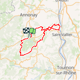
Trail Mountain bike of 54 km to be discovered at Auvergne-Rhône-Alpes, Ardèche, Saint-Romain-d'Ay. This trail is proposed by ramsay.
Description
Randonnée St Romain d'Ay
Positioning
Country:
France
Region :
Auvergne-Rhône-Alpes
Department/Province :
Ardèche
Municipality :
Saint-Romain-d'Ay
Location:
Unknown
Start:(Dec)
Start:(UTM)
630965 ; 5002880 (31T) N.
Comments