Trail Mountain bike Claix - tourbillere de peille - Photo

tourbillere de peille

© OpenStreetMap contributors
Length
Length
19.6 km
Max alt
Max alt
1200 m
Uphill gradient
Uphill gradient
117 m
Km-Effort
Km-Effort  
24 km
Min alt
Min alt
210 m
Downhill gradient
Downhill gradient
1050 m
Boucle
Boucle
No
Creation date :
2014-12-10 00:00:00.0
Updated on :
2014-12-10 00:00:00.0

(0 Reviews)

Mountain bike
Mountain bike
1h28
Difficulty : Medium

Scan this QR Code to open this trail in the SityTrail application

FREE GPS app for hiking

Logo SityTrail SityTrail

IGN / Geographical institutes

Download SityTrail from the App Store Download SityTrail from Google Play

Logo SityTrail SityTrail World

The world is yours!

Download SityTrail from the App Store Download SityTrail from Google Play Download SityTrail on Huawei AppGallery

About

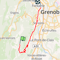
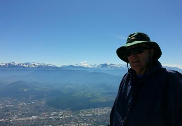
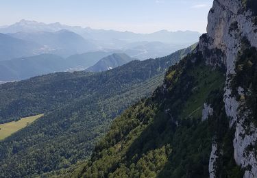
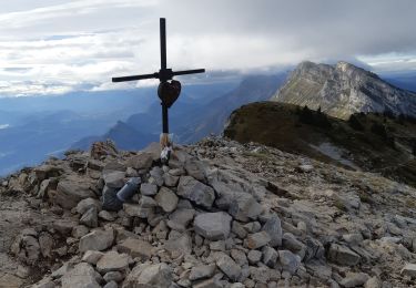
Trail Mountain bike of 19.6 km to be discovered at Auvergne-Rhône-Alpes, Isère, Claix. This trail is proposed by gordolasque.

Description

Il s'agit d'une balade en VTT tres carrosable puisque j'ai été longtemps sur le bitume. La piste forestière est très particable aussi.
L'enregistement de la rando est partielle puisque je suis en fait passé par la route dU Peuil pour la montée.          

Elevation profile

Photos

Points of interest

Positioning

Country:
France
Region :
Auvergne-Rhône-Alpes
Department/Province :
Isère
Municipality :
Claix
Location:
Unknown
Start:(UTM)
707098 ; 4999155 (31T) N.

Trails nearby

Trail Nordic walking Seyssins - Seyssins le haut - Les Arcelles dans la neige - Photo
Nordic walking
patjobou

Nordic walking

Medium
(1)
Seyssins, Auvergne-Rhône-Alpes, Isère, France
9.1 km | 13.8 km-effort
2h 45min
Yes
Trail Walking Seyssins - MOUCHEROTTE - Photo
Walking
Ninie38MD

Walking

Difficult
(1)
Seyssins, Auvergne-Rhône-Alpes, Isère, France
20 km | 40 km-effort
8h 9min
Yes
Trail Snowshoes Lans-en-Vercors - La Crête des Ramées de nuit en raquettes - Photo
Snowshoes
patjobou

Snowshoes

Medium
(1)
Lans-en-Vercors, Auvergne-Rhône-Alpes, Isère, France
8 km | 13.4 km-effort
4h 9min
Yes
Trail Walking Lans-en-Vercors - Le Pic saint michel - Photo
Walking
patjobou

Walking

Easy
(1)
Lans-en-Vercors, Auvergne-Rhône-Alpes, Isère, France
6.5 km | 13.2 km-effort
2h 38min
No
Trail Walking Lans-en-Vercors - le vertige des cimes - Photo
Walking
jeanfcd

Walking

Medium
(1)
Lans-en-Vercors, Auvergne-Rhône-Alpes, Isère, France
6.3 km | 11 km-effort
2h 9min
Yes
Trail Walking Lans-en-Vercors - 38 pic st michel - Photo
Walking
himba26100

Walking

Easy
(1)
Lans-en-Vercors, Auvergne-Rhône-Alpes, Isère, France
8.7 km | 17.3 km-effort
5h 16min
Yes
Trail Mountain bike Seyssins - Petite escapade électrique au-dessus de 38 Seyssins - Photo
Mountain bike
patjobou

Mountain bike

Easy
(1)
Seyssins, Auvergne-Rhône-Alpes, Isère, France
12.3 km | 19.7 km-effort
1h 29min
Yes
Trail Walking Lans-en-Vercors - Lans - Belvédère Vertige des Cimes depuis Le Furon - Photo
Walking
patjobou

Walking

Medium
(1)
Lans-en-Vercors, Auvergne-Rhône-Alpes, Isère, France
8 km | 15.9 km-effort
3h 9min
Yes
Trail Snowshoes Lans-en-Vercors - Le Pic Saint-Michel en raquettes (2012) - Photo
Snowshoes
tracegps

Snowshoes

Medium
(2)
Lans-en-Vercors, Auvergne-Rhône-Alpes, Isère, France
8.4 km | 17.3 km-effort
5h 0min
Yes


Close
My subscriptions