


La montée des antennes de St héand

ramsay
User
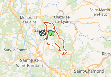

Length
42 km

Max alt
873 m

Uphill gradient
964 m
Km-Effort
55 km

Min alt
382 m

Downhill gradient
963 m
Boucle
Yes
Creation date :
2014-12-10 00:00:00.0
Updated on :
2014-12-10 00:00:00.0
--
Difficulty : Difficult

FREE GPS app for hiking
 SityTrail
IGN / Geographical institutes
SityTrail Plus
The world is yours!
About
Trail Mountain bike of 42 km to be discovered at Auvergne-Rhône-Alpes, Loire, Chambœuf. This trail is proposed by ramsay.
Description
Depuis Chamboeuf jusqu'aux antennes parcours de 42 km
Positioning
Country:
France
Region :
Auvergne-Rhône-Alpes
Department/Province :
Loire
Municipality :
Chambœuf
Location:
Unknown
Start:(Dec)
Start:(UTM)
603127 ; 5047316 (31T) N.
Comments