


20130507

alexbnmr
User
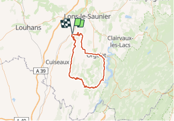

Length
89 km

Max alt
752 m

Uphill gradient
1529 m
Km-Effort
110 km

Min alt
211 m

Downhill gradient
1532 m
Boucle
No
Creation date :
2014-12-10 00:00:00.0
Updated on :
2014-12-10 00:00:00.0
3h39
Difficulty : Difficult

FREE GPS app for hiking
 SityTrail
IGN / Geographical institutes
SityTrail Plus
The world is yours!
About
Trail Cycle of 89 km to be discovered at Bourgogne-Franche-Comté, Jura, Val-Sonnette. This trail is proposed by alexbnmr.
Positioning
Country:
France
Region :
Bourgogne-Franche-Comté
Department/Province :
Jura
Municipality :
Val-Sonnette
Location:
Vincelles
Start:(Dec)
Start:(UTM)
689557 ; 5164064 (31T) N.
Comments