


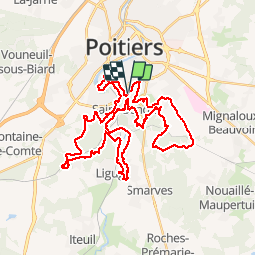
Zevtt - St Benoît 45 km

kipoura
User


11h35
Difficulty : Medium

FREE GPS app for hiking
 SityTrail
IGN / Geographical institutes
SityTrail Plus
The world is yours!
About
Trail Mountain bike of 46 km to be discovered at New Aquitaine, Vienne, Saint-Benoît. This trail is proposed by kipoura.
Description
Un parcours VTT au départ de la salle de la Hune. Circuit typé roulant avec de beaux passages en monotraces et quelques bonnes grimpette. Possibilité de réduire facilement la distance ..... http://zevtt.free.fr
Positioning
Comments