


Fenouillet

perittel
User
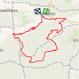

Length
23 km

Max alt
1168 m

Uphill gradient
912 m
Km-Effort
35 km

Min alt
442 m

Downhill gradient
911 m
Boucle
Yes
Creation date :
2014-12-10 00:00:00.0
Updated on :
2014-12-10 00:00:00.0
7h17
Difficulty : Difficult

FREE GPS app for hiking
 SityTrail
IGN / Geographical institutes
SityTrail Plus
The world is yours!
About
Trail Walking of 23 km to be discovered at Occitania, Pyrénées-Orientales, Fenouillet. This trail is proposed by perittel.
Description
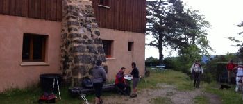
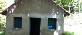
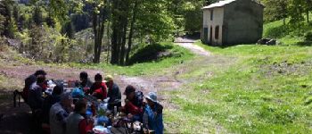
Les Bordes - col de Tulla - Refuge Gai Sourire - Cabane de Gaspesta - Source des Verriers - Col Boire - Les Bordes
Longue randonnée sans difficultés majeures, bon test d''endurance.
Photos


Positioning
Country:
France
Region :
Occitania
Department/Province :
Pyrénées-Orientales
Municipality :
Fenouillet
Location:
Unknown
Start:(Dec)
Start:(UTM)
448943 ; 4737477 (31T) N.
Comments